Easy Walks in the Dolomites: 8 Best Lake and Meadow Walks
Eight easy Dolomites walks from 20 minutes to an hour each way, with the distance, climb, pushchair advice and the bus or lift to every start.
Quick links
Don't want to read all this?
We've planned 2,000+ hiking trips. Send your dates, fitness and group size — we'll map the route and book every night.



Some of the best views in the Dolomites sit at the end of a flat path. You can walk round Lago di Braies under the Croda del Becco, follow the shore of Lago di Misurina with the Sorapis behind the hotels, or cross the Alpe di Siusi meadows with the Sassolungo ahead.
These eight easy walks take 20 minutes to about an hour each way, with no more than 200 m of climb. A bus, shuttle or lift reaches every start, so you can leave the car behind.
Most suit children who can walk for an hour, and seven take a pushchair for at least part of the way. For longer days, see our guide to walking in the Dolomites.
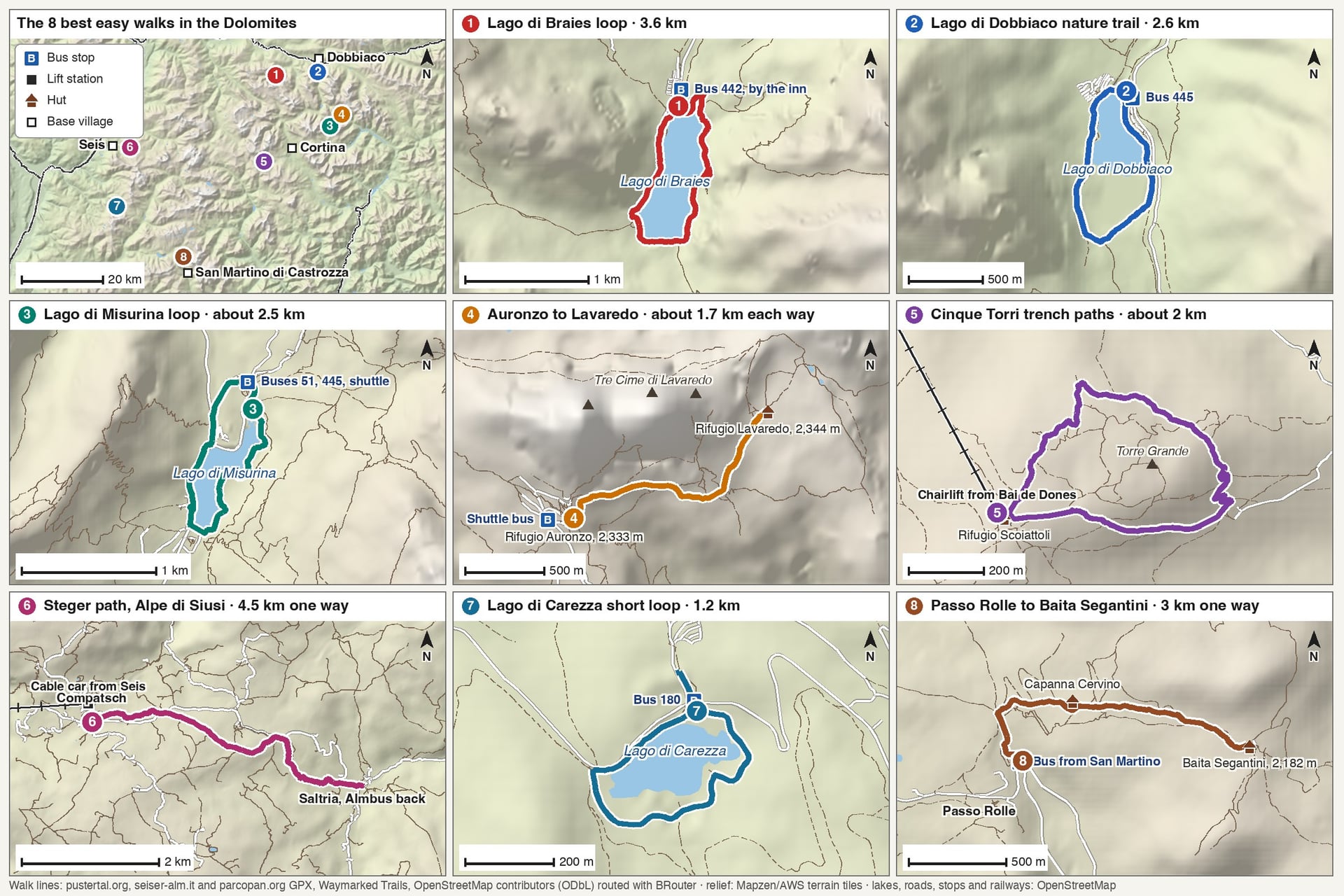
The 8 Best Easy Walks in the Dolomites
The best easy walks in the Dolomites follow lake shores, old trench lines and farm tracks between 1,250 and 2,350 m. They run from the Puster Valley in the north to Passo Rolle in the south, grouped by the village, bus or lift you start from.
Walk | Distance | Climb | Time | Start | Pushchair |
Lago di Braies loop | 3.6 km loop | About 40 m | 1 hour | Bus 442 to the lake | West shore only |
Lago di Dobbiaco nature trail | 2.6 km loop | 10 m | 40 minutes | Bus 445 to the lake | Yes |
Lago di Misurina loop | About 2.5 km loop | Almost flat | 30 to 40 minutes | Bus 51 or 445 to Misurina | Yes |
Rifugio Auronzo to Rifugio Lavaredo | About 1.7 km each way | About 10 m | 20 minutes each way | Shuttle bus to Rifugio Auronzo | Sturdy pushchair only |
Cinque Torri trench paths | About 2 km on the longest loop | About 80 m | 20 minutes to 2 hours | Chairlift from Bai de Dones | No |
Steger path, Alpe di Siusi | 4.5 km one way | Gentle, mostly downhill | A little over 1 hour | Seis cable car to Compatsch | Yes |
Lago di Carezza short loop | 1.2 km loop | About 20 m | 20 minutes | Bus 180 to the lake | Yes |
Passo Rolle to Baita Segantini | 3 km one way | 200 m | About 1 hour up | Bus to Passo Rolle | To Capanna Cervino |
1. Lago di Braies Lakeside Loop
Distance: 3.6 km loop
Time: about 1 hour
Climb: about 40 m, from 1,492 m to 1,531 m
Path: a wide path on the west shore; roots and a short climb along a rock wall on the east side
Start: the Lago di Braies inn, by bus 442 from Dobbiaco or Villabassa, or 4.8 km on foot from Ferrara
Pushchair: on the west shore, out and back the same way
Best for: families and a first day
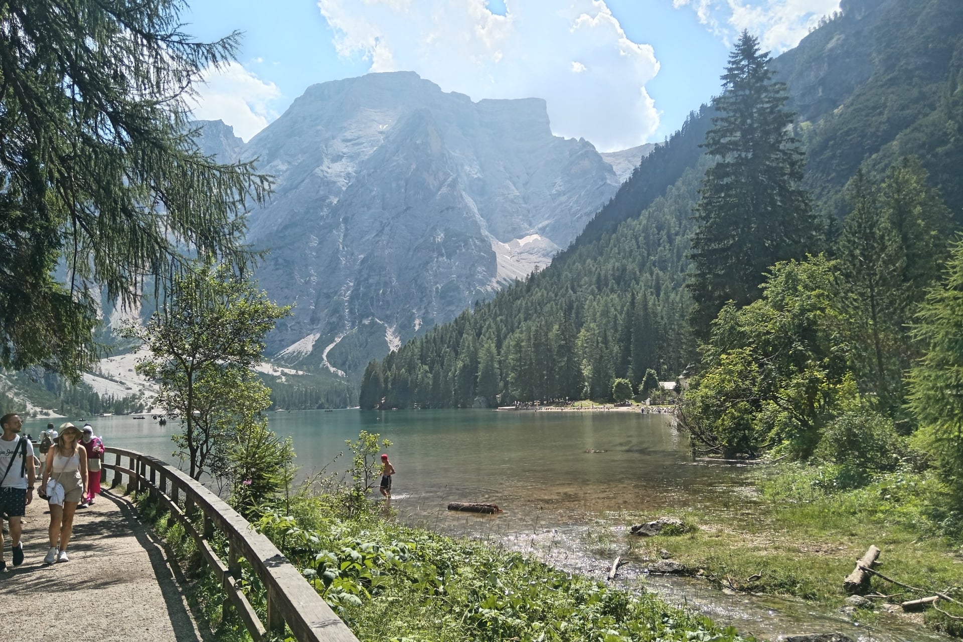
Lago di Braies lies at 1,496 m below the 2,810 m Croda del Becco, inside the Fanes-Sennes-Braies Nature Park. The signposted Seeweg starts at the inn and circles the shore in about an hour, with small beaches and toilets at the southern end.
With a pushchair, stay on the wide west shore and turn back at the beaches, because the east side narrows over roots. From 1 July to 15 September 2026, cars needed a booking from 9:00 to 16:00, and so did seats on bus 442.
2. Lago di Dobbiaco Nature Trail
Distance: 2.6 km loop, or 7.9 km from Dobbiaco village and back
Time: 40 minutes, or 2 hours 30 from the village
Climb: 10 m on the loop, from 1,257 m to 1,264 m
Path: level gravel paths and wooden boardwalks across a wetland
Start: the car park at the lake, 4 minutes from Dobbiaco station on bus 445
Pushchair: yes, all the way round
Best for: an arrival day and small children
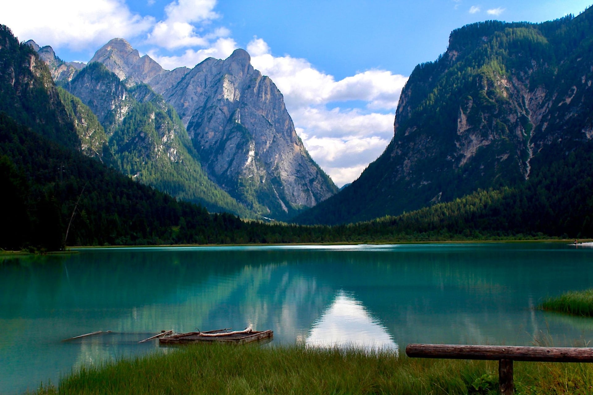
At the mouth of the Valle di Landro, south of Dobbiaco, a nature trail circles this green lake. It was laid out in 2000 with 11 stations on plants, animals and the shape of the valley, and it stays level all the way round.
Boardwalks cross one of the few wetlands left in South Tyrol, and a platform looks out over the water birds. A pebble beach makes a good stop for children. From the Dobbiaco tourist office, a gravel road past the cross-country stadium turns the loop into 7.9 km with 61 m of climb.
3. Lago di Misurina Loop
Distance: about 2.5 km loop
Time: 30 to 40 minutes
Climb: almost none; the lake lies at 1,754 m
Path: a level, well-kept shore path, partly a promenade beside the road
Start: the Misurina Genzianella stop, on bus 51 from Cortina or bus 445 from Dobbiaco
Pushchair: yes
Best for: pairing with walk 4, as the Tre Cime shuttle leaves from the same stop
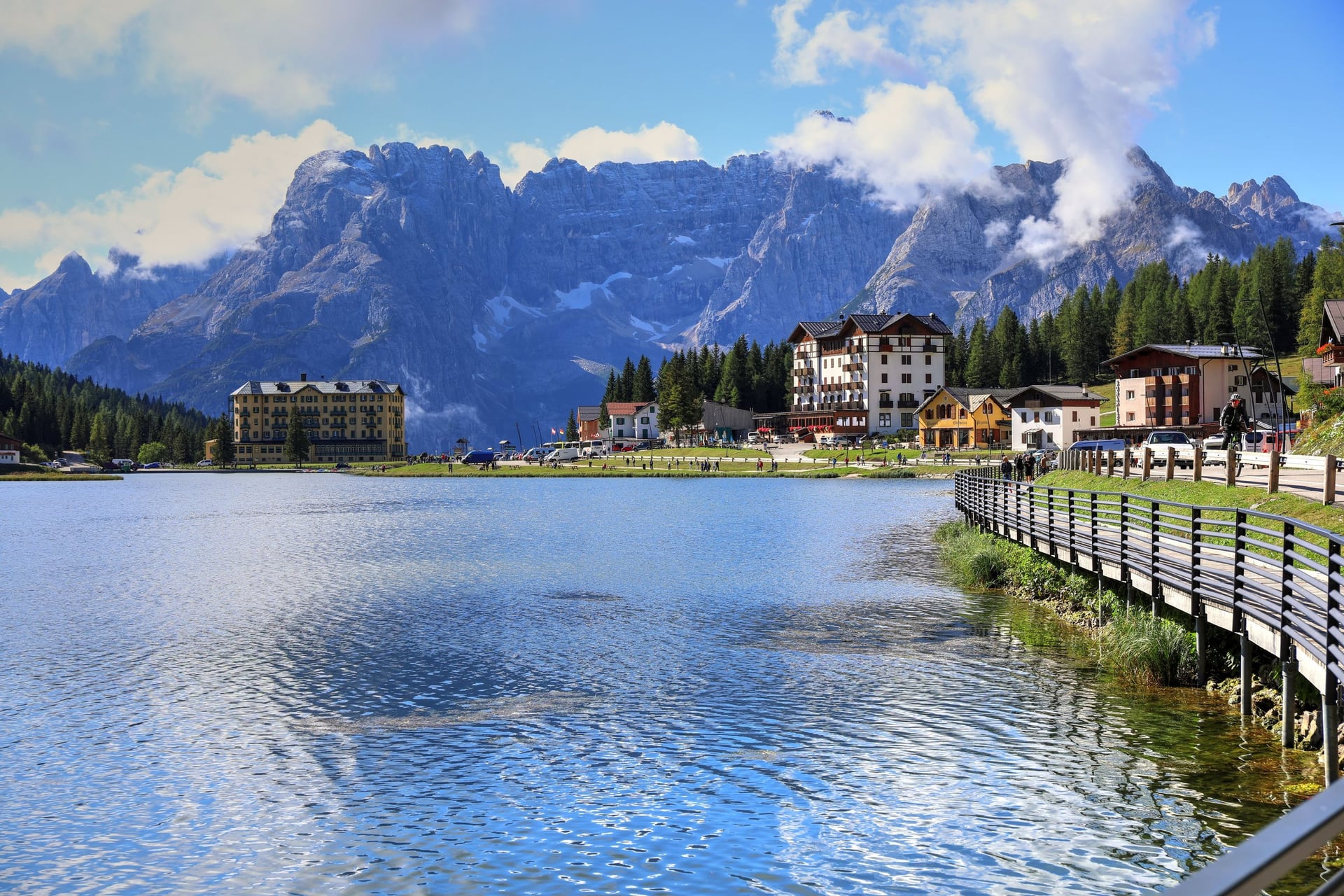
Misurina is a small resort at 1,754 m on the road between Cortina and Dobbiaco, and its lake has one of the easiest circuits in the Dolomites. The shore path stays flat for about 2.5 km, past benches, bars and hotels, with the Sorapis group above the southern end.
The clean air here once made Misurina the home of a centre for children with asthma. Bus 51 reaches the Genzianella stop in 35 minutes from Cortina, and bus 445 in 30 minutes from Dobbiaco. A lap of the lake fits before or after the Tre Cime.
4. Rifugio Auronzo to Rifugio Lavaredo
Distance: about 1.7 km each way on path 101
Time: about 20 minutes each way
Climb: almost none, from 2,333 m to 2,344 m
Path: a wide gravel track below the south walls of the Tre Cime
Start: Rifugio Auronzo, by the shuttle bus from Misurina or the toll road
Pushchair: a sturdy all-terrain pushchair, as far as Rifugio Lavaredo
Best for: seeing the Tre Cime up close without a climb
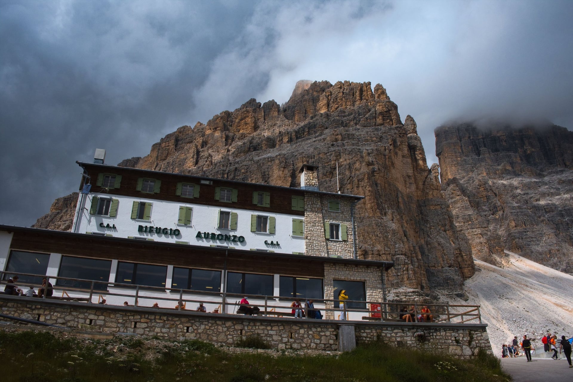
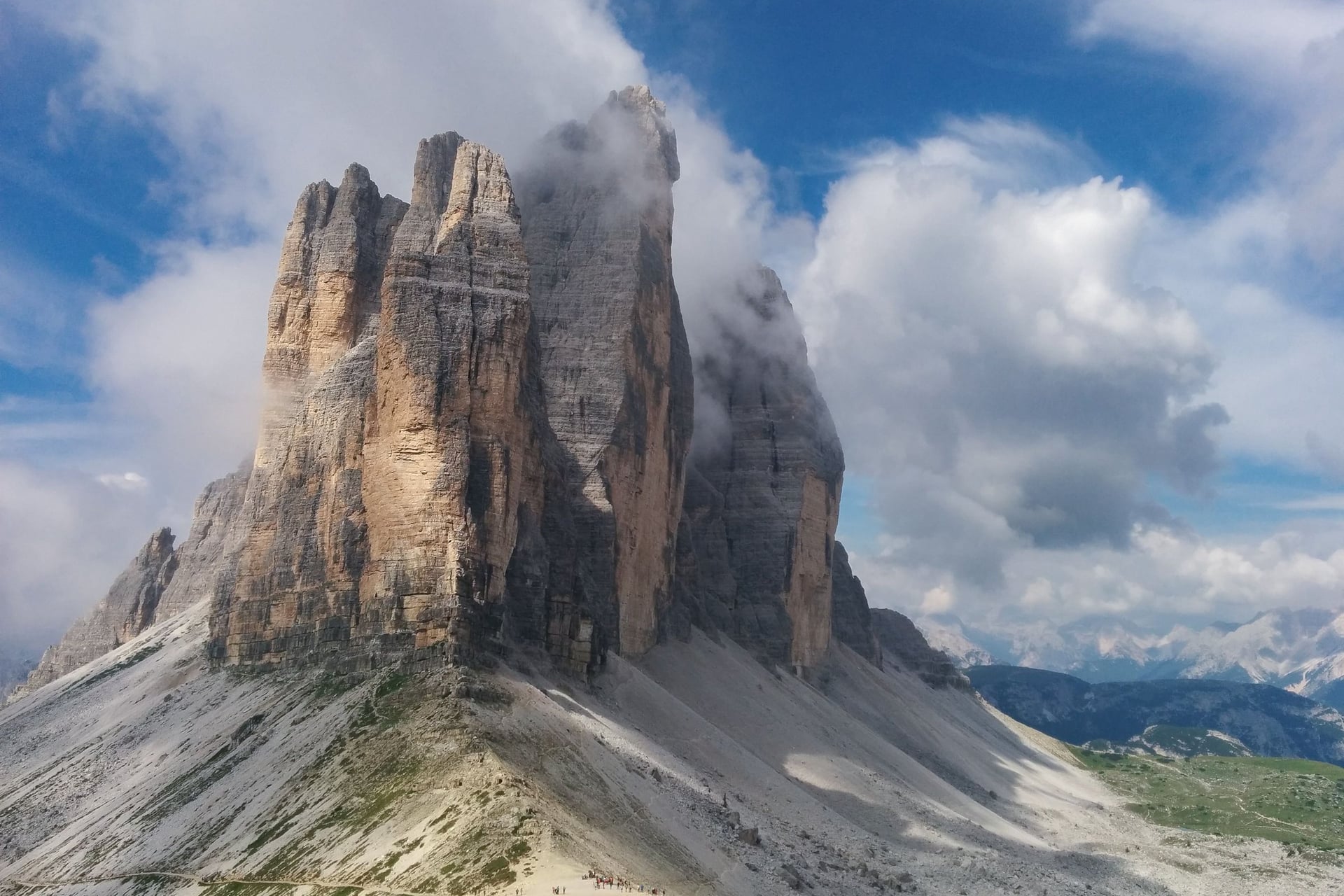
The Tre Cime di Lavaredo look like climbers' mountains, yet the first 20 minutes round them are flat. Path 101 leaves Rifugio Auronzo at 2,333 m, where the road ends, and follows a wide track under the south walls. Rifugio Lavaredo, at 2,344 m, calls the path completely level.
If you came for an easy walk, turn round at Rifugio Lavaredo. Above the hut the path climbs steeply on rock to Forcella Lavaredo (2,454 m), where the north faces come into view. Rifugio Locatelli, at 2,405 m, is 1.5 hours from Auronzo that way, and the full loop takes 3 to 4 hours.
5. Cinque Torri Trenches and Open-Air Museum
Distance: four marked museum paths; about 2 km on the round of the towers
Time: 20 minutes to 2 hours
Climb: about 80 m of ups and downs on the round of the towers
Path: stony mountain paths through First World War trenches
Start: Rifugio Scoiattoli (2,255 m), by chairlift from Bai de Dones on bus route 52 from Cortina
Pushchair: no
Best for: children who like exploring, and First World War history
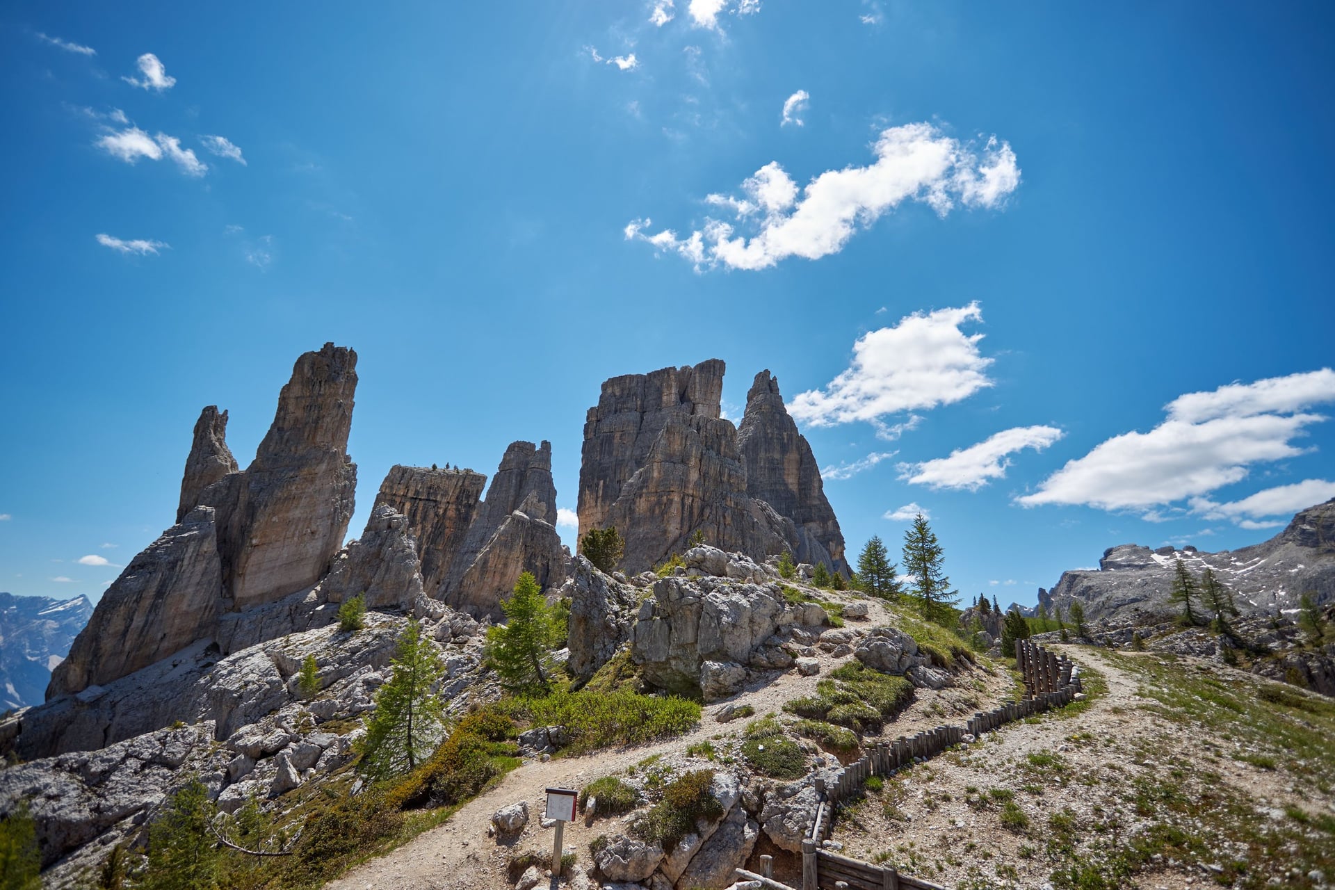
Five rock towers stand on open grass west of Cortina, and Italian soldiers lived in the trenches around them from 1915 to 1917. The trenches now form an open-air museum, five minutes' walk from the top of the chairlift.
Four marked paths start there: the upper trench takes about 20 minutes, the trench path 30 minutes and the round of the towers about 2 hours. These are mountain paths, so wear walking shoes for the stony trenches. The chairlift climbs from 1,889 m to 2,255 m and ran from 6 June to 11 October in 2026.
6. Alpe di Siusi (Seiser Alm): The Steger Path to Saltria
Distance: 4.5 km one way on path 30
Time: a little over an hour
Climb: gentle and mostly downhill, from 1,917 m to 1,674 m
Path: a wide track, paved in places, across open pasture
Start: Compatsch, 15 minutes from Seis on the Seiser Alm cable car; Almbus 11 back from Saltria
Pushchair: yes
Best for: older walkers, and grandparents with grandchildren
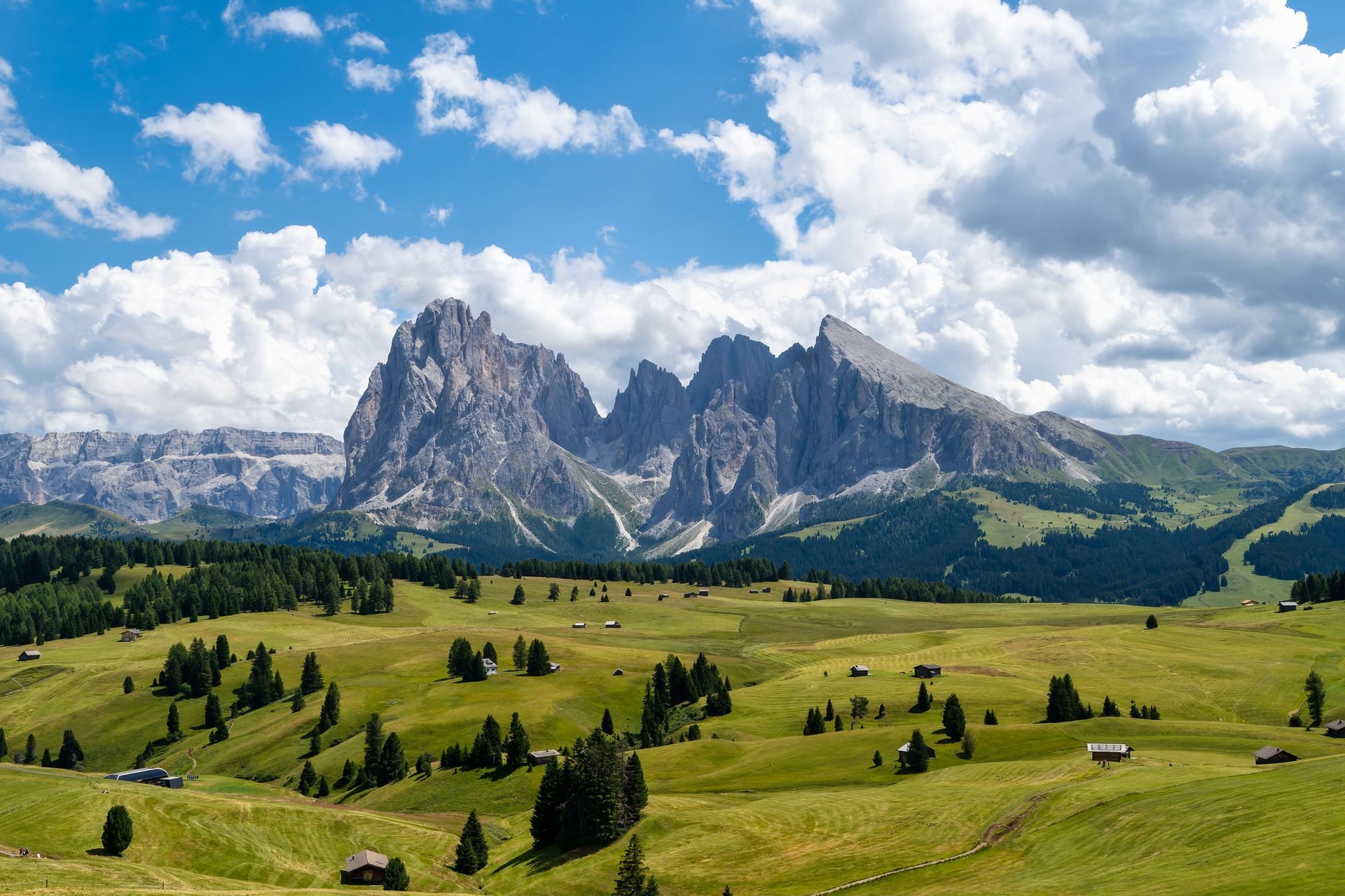
The Alpe di Siusi covers 56 square kilometres, and the local tourist board calls it the largest high-Alpine pasture in Europe. The Hans and Paula Steger path is the gentlest way across: 4.5 km on wide tracks from the church at Compatsch, at about 1,850 m, to Saltria at 1,680 m.
From Saltria, the Almbus saves the walk back uphill, so the outing can go one way only. The Seis cable car takes 15 minutes up to Compatsch. All nine plateau routes are in our guide to Alpe di Siusi walks.
7. Lago di Carezza Short Loop
Distance: 1.2 km loop, or 3.8 km on the long loop
Time: 20 minutes, or about 1 hour on the long loop
Climb: about 20 m, from 1,539 m to 1,554 m; 98 m on the long loop
Path: a yellow-marked path from the car park, through an underpass to a viewing platform
Start: the Karer See stop on bus 180, hourly from Bolzano
Pushchair: yes, on the short loop
Best for: a short stop on a travel day
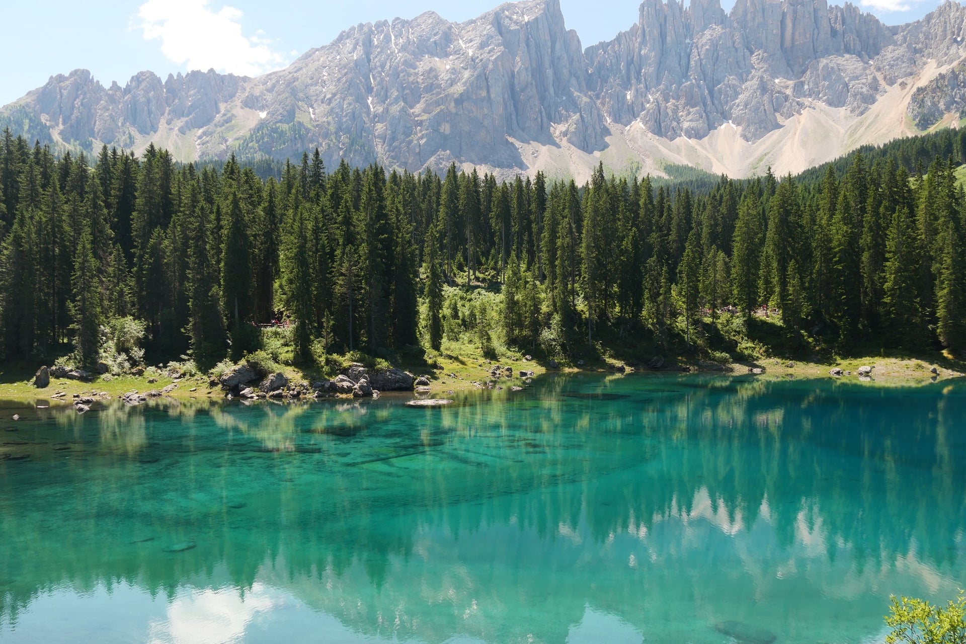
Below the Latemar, Lago di Carezza is a spring-fed lake at 1,520 m, 300 m long, 140 m wide and up to 22 m deep. The short loop leaves the car park through an underpass, turns left to a viewing platform and circles the lake clockwise in about 20 minutes.
The lake is a protected natural monument, so you stay behind the fences and may not swim. The orange-marked long loop climbs 98 m through the forest towards the Costalunga pass road, 3.8 km in about 1 hour.
8. Passo Rolle to Baita Segantini
Distance: 3 km one way
Time: about 1 hour up
Climb: 200 m, from 1,984 m to 2,182 m
Path: a gravel road closed to cars
Start: Passo Rolle, 15 minutes by bus from San Martino di Castrozza
Pushchair: as far as Capanna Cervino (2,082 m), 30 minutes up
Best for: a close view of the Pale di San Martino
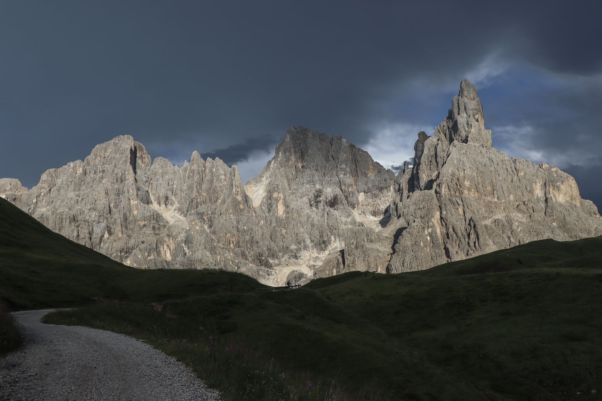
South of the other walks, Passo Rolle sits at 1,984 m under the Pale di San Martino. A gravel road climbs from the pass to Baita Segantini at 2,182 m, facing the 3,186 m Cimon della Pala, which locals call the Matterhorn of the Dolomites.
This is the steepest walk here, with 200 m of climb in an hour, but a summer shuttle runs up from the pass in 15 minutes, so you can ride up and walk down. The Colbricon lakes (1,909 m and 1,922 m) lie 2 km from Malga Rolle, on a path too rough for pushchairs.
How Hard Are Easy Walks in the Dolomites?
None of the eight walks crosses exposed ground, and the longest is 4.5 km one way. The effort comes from altitude, a few rocky stretches and the weather.
Paths, Altitude and Shoes
Four of the walks circle lakes between 1,250 m and 1,760 m. The other four start between 1,850 m and 2,333 m, where the air is cooler and storms build faster. At 2,051 m on the Alpe di Siusi, July days average 17.1 °C.
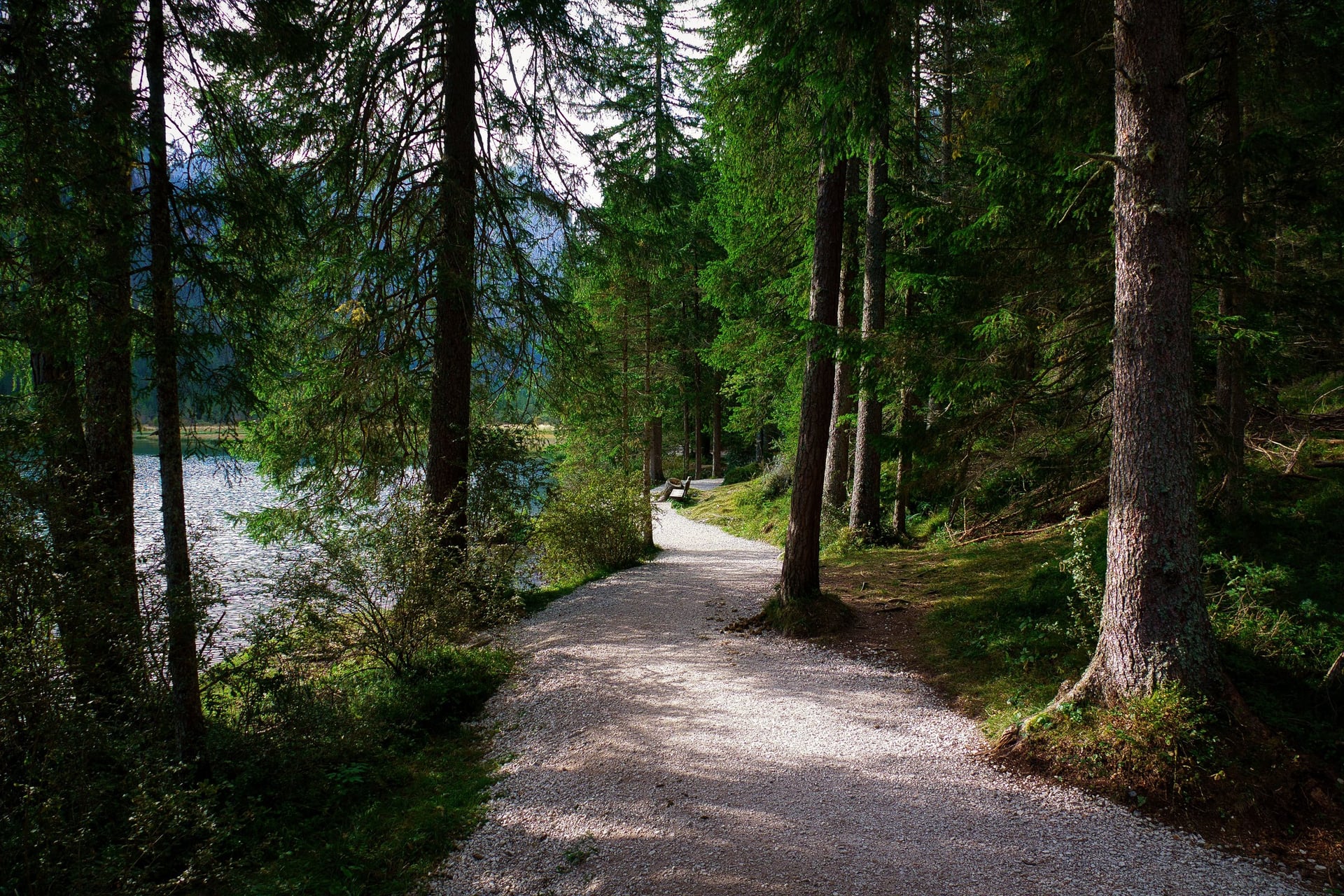
Trainers are fine on the gravel at Dobbiaco, Misurina and Carezza and on the Steger path. Wear walking shoes with grip for the roots on the east shore at Braies, the stony trench paths at the Cinque Torri and the rocks above Rifugio Lavaredo.
Easy Walks for Families and Pushchairs
For small children, pick a walk with something at the end of it: the beach at Lago di Dobbiaco, the trenches at the Cinque Torri, the boats at Misurina or the Almbus at Saltria. Most of the list suits children who can walk for an hour.
With a pushchair, four walks are smooth all the way: the Dobbiaco nature trail, the Misurina loop, the Carezza short loop and the Steger path. At Braies use the west shore only. On the Tre Cime track and the Segantini road, an all-terrain pushchair copes as far as Rifugio Lavaredo and Capanna Cervino.
Several lifts and buses carry children free: under-8s on the Cinque Torri chairlift with their parents, under-6s on the Almbus and, in 2026, children born in 2018 or later on the Seis cable car.
Famous Walks That Are Harder Than They Look
Some walks described as easy online are half-day mountain walks. Three of the best known start near the easy walks above. Check their figures before you set off.
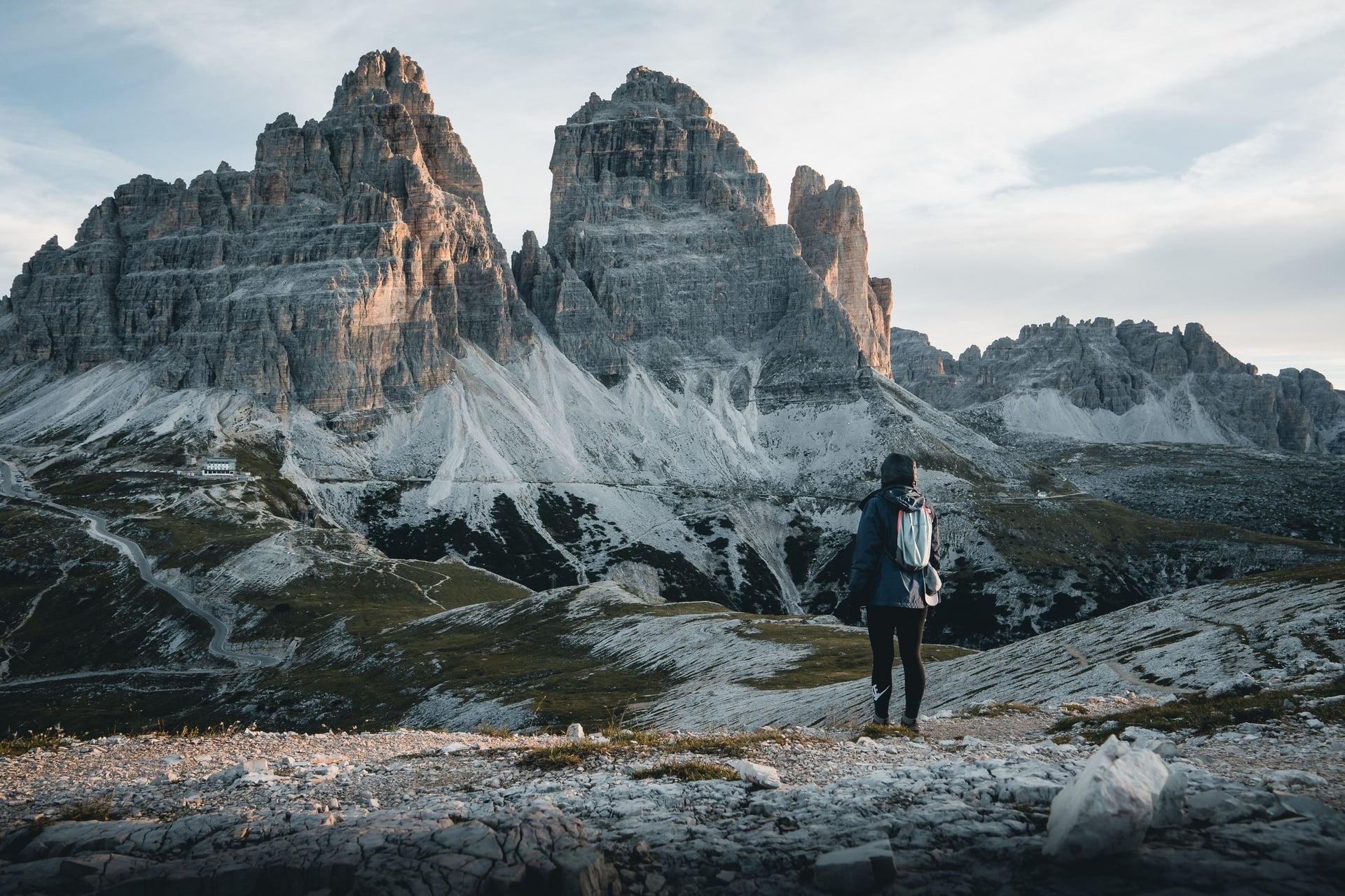
Tre Cime di Lavaredo loop: about 10 km and 400 m of climb in 3 to 4 hours, with a steep, rocky climb to Forcella Lavaredo at 2,454 m
Lago di Sorapis: 10.5 km there and back with 434 m of climb, about 4 hours; path 215 has metal ladders and a ledge with wire ropes
Lago Federa: about 4.3 km each way and 340 m of climb from the Passo Giau road, about 2 hours up on forest paths
In July and August, start all three early: afternoon thunderstorms are common, and the Sorapis path is at its busiest by mid-morning.
Best Time for Easy Walks in the Dolomites
The easy-walk season runs from late May to mid-October, and the lift and bus timetables matter as much as the weather.
Late May and June: the Seis cable car opened on 22 May and the Tre Cime shuttle on 30 May in 2026. The Cinque Torri chairlift followed on 6 June, and Dobbiaco averages 20.1 °C by day in June
July and August: the warmest and busiest months, 22.6 °C by day in Dobbiaco in July; the Braies access rules apply from 1 July, and afternoon storms are common
September: 18.1 °C by day in Dobbiaco and only 8 rain days; the Braies rules end on 15 September, but bus 51 from Cortina to Misurina thins out from 10 September
October: 12.9 °C by day in Dobbiaco; the Cinque Torri chairlift closed on 11 October in 2026, while the lake loops stay open
November to May: snow covers the higher walks and most lifts and summer buses stop, but the Dobbiaco nature trail is listed as a walk for every month
For easy walks, June and September suit best, with open lifts and quieter paths. Our guide on when to visit the Dolomites goes through every month.
Know Before You Arrive
Each start has its own bus or lift and, at the busiest lakes, its own summer booking rule, so plan the journey before the walk.
Getting to the Start Without a Car
Every walk starts at a bus stop or a lift station, and most buses need no booking at all. In summer 2026 only the buses to Lago di Braies (442 and 439) and bus 444 from Dobbiaco to the Tre Cime had to be booked online.
Walk | Bus or lift | From | Book ahead? |
Lago di Braies | Bus 442; bus 439 in high season | Dobbiaco or Villabassa; Monguelfo station | Yes, 1 July to 15 September |
Lago di Dobbiaco | Bus 445 | Dobbiaco station, 4 minutes | No |
Lago di Misurina | Bus 51; three buses 445 a day | Cortina, 35 minutes; Dobbiaco | No |
Rifugio Auronzo | Tre Cime shuttle bus | Misurina Genzianella | No; card or app, no cash |
Cinque Torri | Bus 52, then the chairlift | Cortina | No |
Alpe di Siusi | Seiser Alm cable car | Seis | No |
Lago di Carezza | Bus 180, hourly | Bolzano | No |
Passo Rolle | Local bus | San Martino di Castrozza, 15 minutes | No |
Driving is restricted at three of the starts. In 2026 the Braies valley needed a car booking from 9:00 to 16:00 between 1 July and 15 September, and the Tre Cime toll road takes only cars booked online.
The Seiser Alm road is closed to private cars from 9:00 to 17:00 while the cable car runs. Flights, trains and transfers are in our guide on how to get to the Dolomites.
How Much It Costs
The walks themselves are free; you pay for the bus, lift or parking at the start, and a car at Braies in high summer costs more than a lift. These are the 2026 prices:
Lago di Braies: a combined ticket of €44 per car, with the valley permit, a parking place and a €22 voucher for the restaurant or shop
Tre Cime: €10 for a day ticket on the shuttle from Misurina, or €40 per car on the toll road
Cinque Torri chairlift: €27.50 return, €30 in August
Seiser Alm cable car: €30 return, €21 single, €65 return for a family; €4 for a single on the Almbus
Parking at Compatsch: €30 a day, booked online from 29 June 2026
Mobilcard: €32 for 3 days or €52 for 7 days on South Tyrol buses and trains, but not on the Braies buses during the summer rules
Many South Tyrol hotels include the Südtirol Guest Pass, which covers regional buses and trains at no extra cost. It is not valid on the Braies buses during the summer rules or on the Almbus.
What to Pack
Above 1,800 m the weather changes fast, so even for a lake walk pack for cold and rain as well as sun.
Shoes with grip for Braies, the Cinque Torri and the Tre Cime track; trainers do on the other walks
A waterproof and a warm layer, as July days at 2,051 m average only 17.1 °C
Sun cream, a sun hat and water, because the Alpe di Siusi and Passo Rolle walks have little shade
A bank card or the bus app for the Tre Cime shuttle, which takes no cash on board
Your bus booking for Lago di Braies between 1 July and 15 September
How Much Harder Is a Walking Holiday?
A walking holiday here is a step up from these walks. On our self-guided weeks, days last 4 to 6 hours with around 600 m of climb, and several of them start on an easy walk and keep going.
Lifts and buses shorten many days, and the hotels, routes and GPS tracks are arranged for you. Two of them cover walks from the list above:
Alta Pusteria Walking Holidays: 8 days / 7 nights from Dobbiaco, with six walking days of 8.5 to 20.5 km. Day 4 walks past Lago di Braies to the Hochalm pastures, and day 7 goes right round the Tre Cime
Alpe di Siusi Inn to Inn: 7 days / 6 nights from Kastelruth to Ortisei, with your luggage moved between hotels; days 4 and 5 cross the plateau with 310 to 340 m of climb
Both include hotels with breakfast, a digital guidebook and the GPS navigation app. Ask us about dates for next summer.
Come early to Lago di Braies or Misurina on a still morning, and you walk the shore path with the mountains lying upside down in the water beside you.
Frequently Asked Questions



Plan with a hiking expert
Free advice from a team that knows these routes inside out - real people, not a bot

Hassle-Free
We handle route planning, accommodations, transfers, and anything else you prefer not to deal with, so you can enjoy a carefree hike.

Book With Confidence
We are a financially protected company, fully bonded and insured, keeping your money safe and allowing you to travel with confidence.

Tried & Tested Adventures
Only the best hiking adventures in Slovenia, cherry-picked by our local team with an in-depth knowledge of the region.

Unbeatable Support
Our 24/7 customer support is where we show our passion, bringing you a better experience by making your well-being our number one priority.