Walking in the Dolomites: 12 Best Walks, Braies to the Tre Cime
Twelve Dolomites walks, from the Braies lake shore to the Tre Cime loop, with the distance, climb and terrain of each, the best base and the bus or lift.
Quick links
Don't want to read all this?
We've planned 2,000+ hiking trips. Send your dates, fitness and group size — we'll map the route and book every night.



Walking in the Dolomites takes you along lake shores and through hay meadows under pale walls of rock. You stop for lunch on a hut terrace at 2,000 m and sleep in a valley village. Much of this rock began as atolls in a tropical sea, and UNESCO listed the range in 2009.
Lifts and buses do much of the climbing for you. Most of these walks start at a lift station or bus stop above 1,800 m, so the day is spent on the high paths.
These twelve walks run from an hour on a lake shore to a full day in a high valley. They are spread over five valleys, from Dobbiaco in the north to San Martino di Castrozza in the south.
The 12 Best Walks in the Dolomites
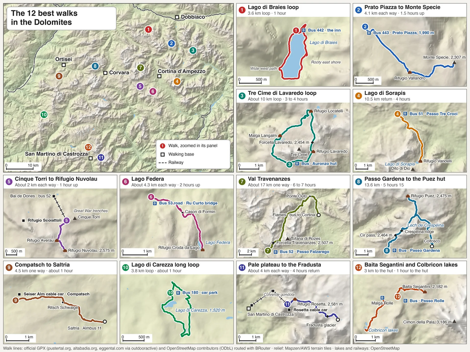
The best walks in the Dolomites are spread across five valleys, and each valley has its own buses, lifts and summer access rules. These day walks in the Dolomites run from north-east to south-west, grouped by the base you would walk from.
Walk | Base | Distance | Climb | Time | Start |
Lago di Braies loop | Dobbiaco | 3.6 km loop | About 40 m | 1 hour | Bus 442 to the lake |
Prato Piazza to Monte Specie | Dobbiaco | 4.1 km each way | 359 m | 1.5 hours up | Bus 443 to Prato Piazza |
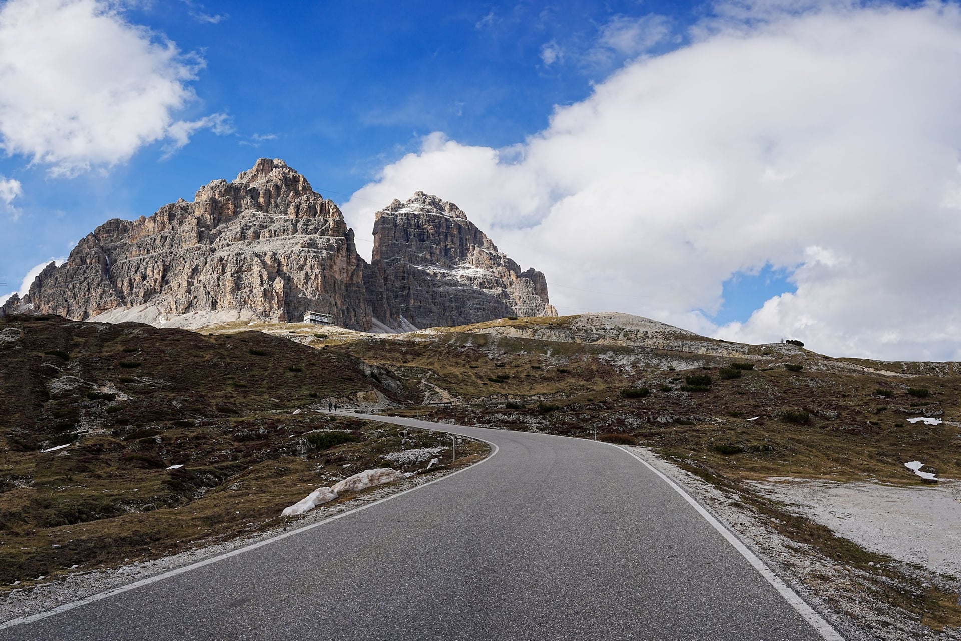
Tre Cime di Lavaredo loop | Dobbiaco or Cortina | About 10 km loop | About 400 m | 3 to 4 hours | Bus to Rifugio Auronzo |
Lago di Sorapis | Cortina d'Ampezzo | 10.5 km return | 434 m | 4 hours | Bus 51 to Passo Tre Croci |
Cinque Torri to Rifugio Nuvolau | Cortina d'Ampezzo | About 2 km each way | 320 m | 1 hour up | Chairlift from Bai de Dones |
Lago Federa | Cortina d'Ampezzo | About 4.3 km each way | About 340 m | 2 hours up | Bus 53 to the Giau road |
Val Travenanzes | Cortina d'Ampezzo | About 17 km one way | About 570 m up, 1,390 m down | 6 to 7 hours | Bus 52 to Passo Falzarego |
Passo Gardena to the Puez hut | Corvara | 13.6 km | 581 m | 5 hours 15 | Bus to Passo Gardena |
Compatsch to Saltria | Seis | 4.5 km one way | Gentle | About 1 hour | Seiser Alm cable car |
Lago di Carezza long loop | Bolzano, by bus | 3.8 km loop | 98 m | About 1 hour | Bus 180 to the lake |
Pale plateau to the Fradusta | San Martino di Castrozza | About 4 km each way | Rolling, 2,540 to 2,704 m | 4 hours return | Colverde and Rosetta lifts |
Baita Segantini and Colbricon lakes | San Martino di Castrozza | 3 km to the hut | 200 m | 1 hour to the hut | Bus to Passo Rolle |
1. Lago di Braies Lakeside Loop
Distance: 3.6 km loop
Time: about 1 hour
Climb: about 40 m, between 1,492 and 1,531 m
Terrain: a wide path on the west shore; narrower and rooty, with a short climb above the water, on the east side
Start: the Lago di Braies inn, by bus 442 from Dobbiaco, booked online from 1 July to 15 September
Best for: a first day, and families
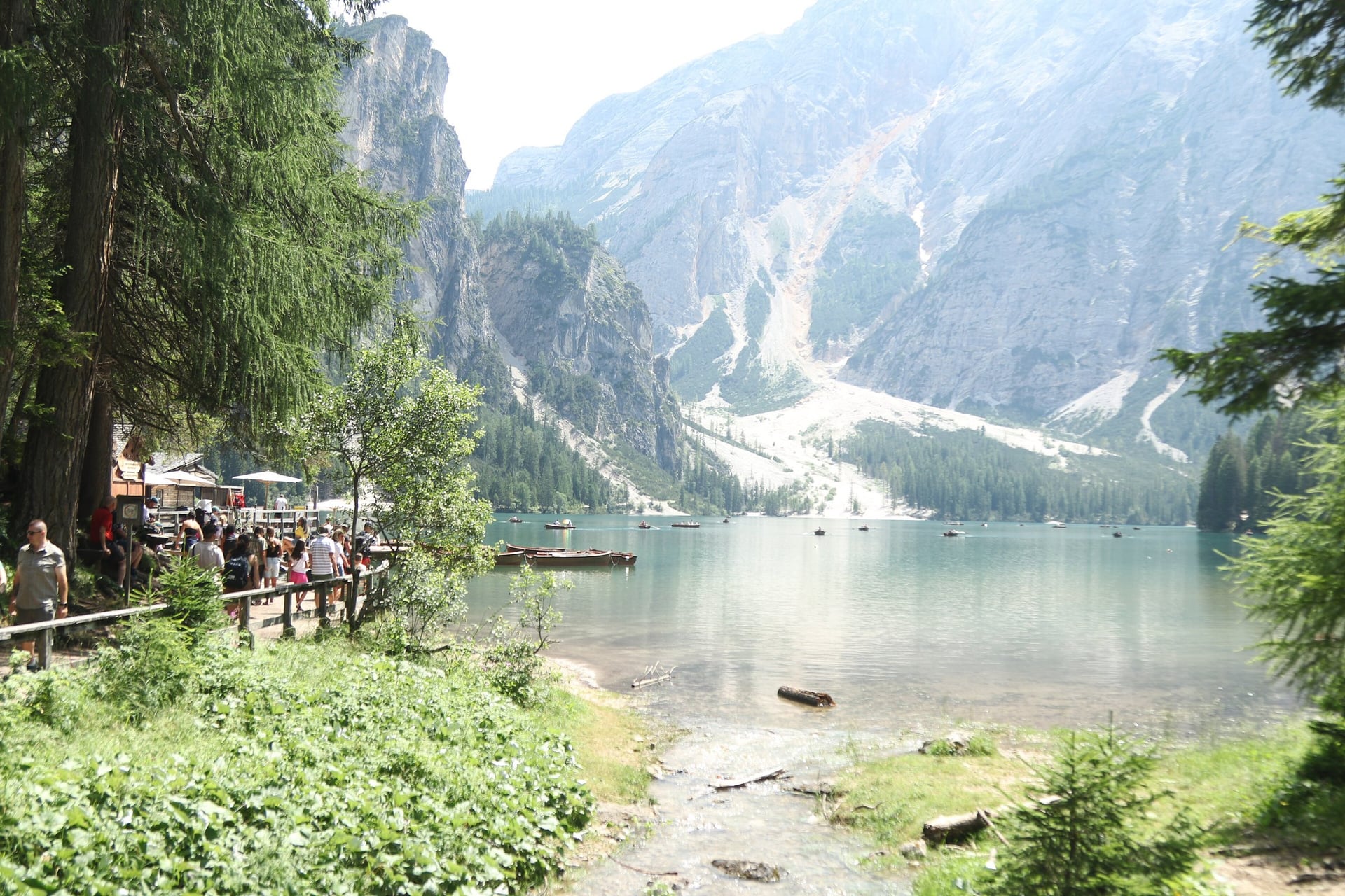
Below the 2,810 m Croda del Becco, Lago di Braies lies at 1,496 m inside the Fanes-Sennes-Braies Nature Park. The signposted Seeweg circles the shore in about an hour, and part of the path is wide enough for a pushchair.
Access is the hard part in summer. Under the Braies valley rules, from 1 July to 15 September 2026 cars could enter from 9:00 to 16:00 only with a booking, and seats on bus 442 had to be booked online too. Our guide to easy walks in the Dolomites has more lake loops like this one.
2. Prato Piazza and Monte Specie
Distance: 4.1 km each way
Time: about 1.5 hours up
Climb: 359 m, to the 2,305 m top
Terrain: gravel tracks and grassy paths, easy ground to the summit
Start: Prato Piazza (1,990 m), by bus 443 from Dobbiaco, 6 June to 8 November 2026
Best for: a high meadow walk without a long climb
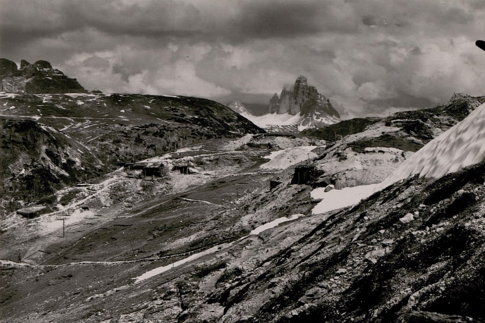
Prato Piazza is a high pasture at about 2,000 m, with the Dürrenstein, the Croda Rossa and Monte Cristallo around it. The path to Monte Specie passes Rifugio Vallandro (2,040 m) and the old Austrian fort of Prato Piazza, then climbs easy ground to a 2,305 m top. The short loop to Rifugio Vallandro on path 40A passes several First World War remains.
Bus 443 needs no booking, but tickets are sold on board for cash only. Strong walkers can climb the Dürrenstein (2,839 m) instead: 9.3 km return with 849 m of climb and short secured passages.
3. Tre Cime di Lavaredo Loop
Distance: about 10 km loop
Time: 3 to 4 hours
Climb: about 400 m, with Forcella Lavaredo (2,454 m) the highest point
Terrain: a wide, flat track to Rifugio Lavaredo, then rocky paths with short, steep climbs and descents
Start: Rifugio Auronzo (2,333 m), by shuttle bus from Misurina, or by bus 444 from Dobbiaco, booked online
Best for: the north faces of the three towers
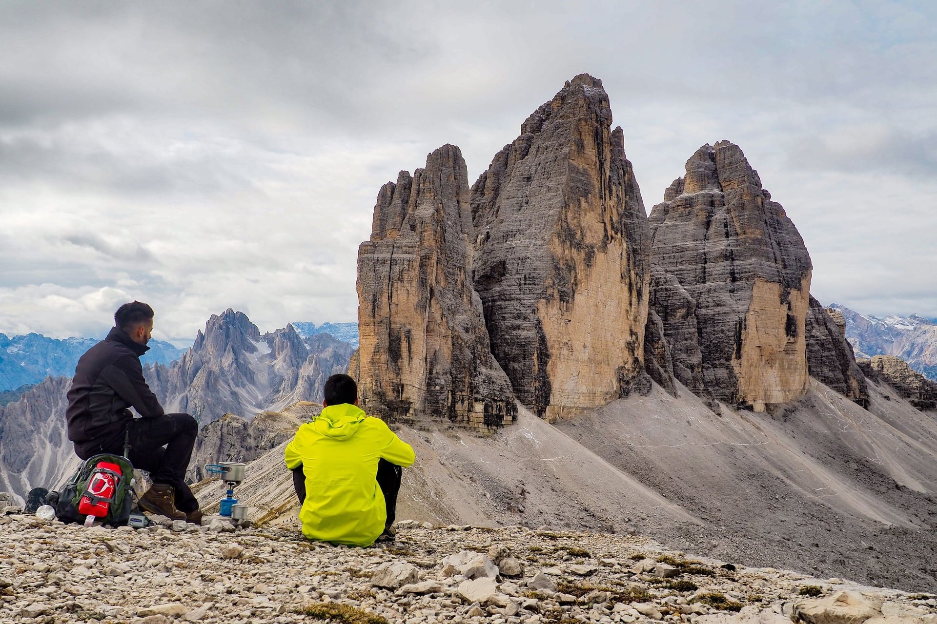
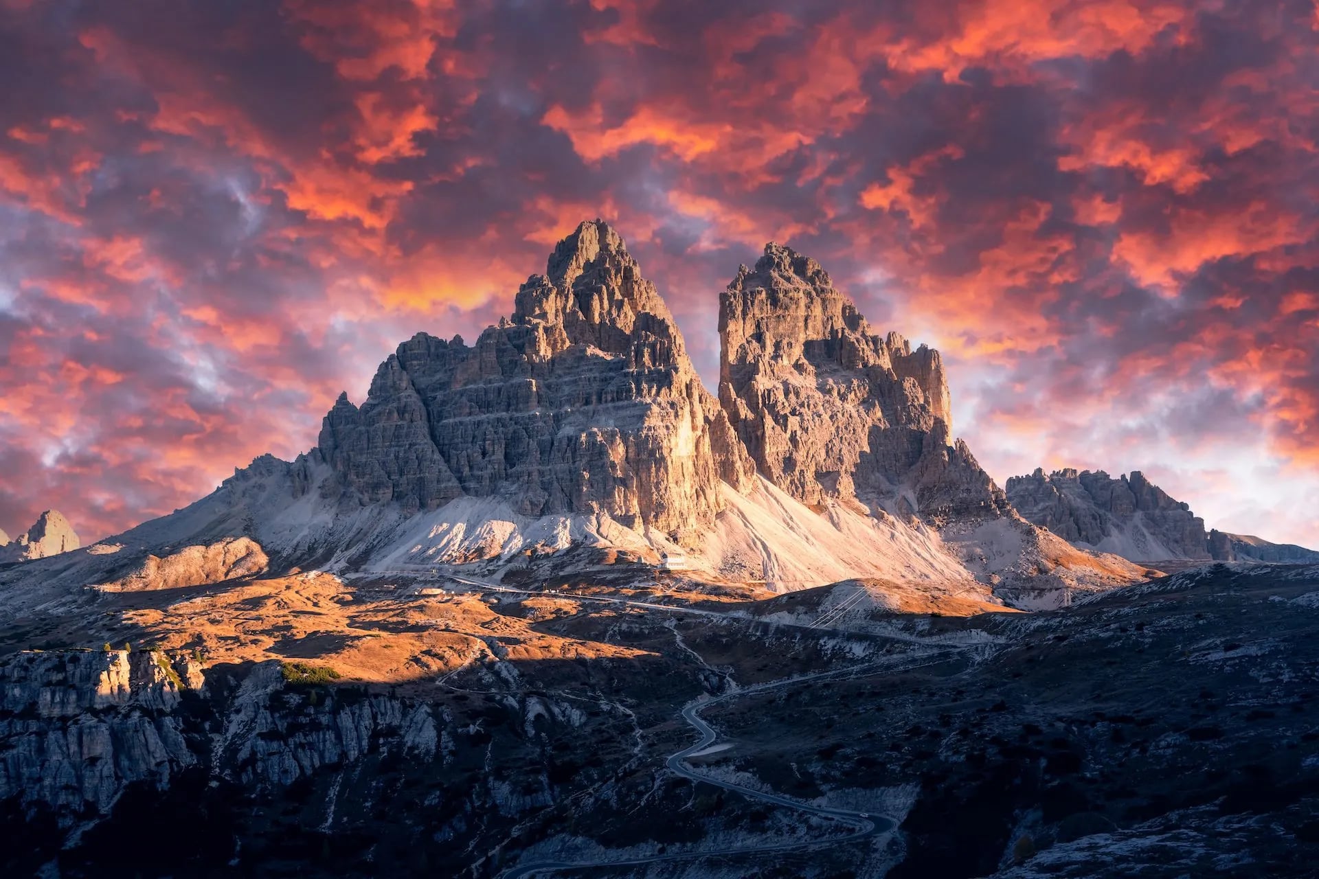
The loop circles three towers: Cima Grande (2,999 m), Cima Ovest (2,973 m) and Cima Piccola (2,857 m). From Rifugio Auronzo, path 101 runs flat for 20 minutes to Rifugio Lavaredo. It then climbs to Forcella Lavaredo, where the north faces come into view above Rifugio Locatelli (2,405 m).
The return on path 105 passes Malga Langalm and Forcella Col di Mezzo. Rifugio Locatelli opens only in summer, from late June to late September, and it accepts no cards, so carry cash.
4. Lago di Sorapis
Distance: 10.5 km return
Time: about 4 hours
Climb: 434 m
Terrain: a flat start, then metal ladders and a flat ledge with wire ropes on path 215
Start: Passo Tre Croci (1,805 m), 23 minutes from Cortina on bus 51
Best for: sure-footed walkers with a head for heights
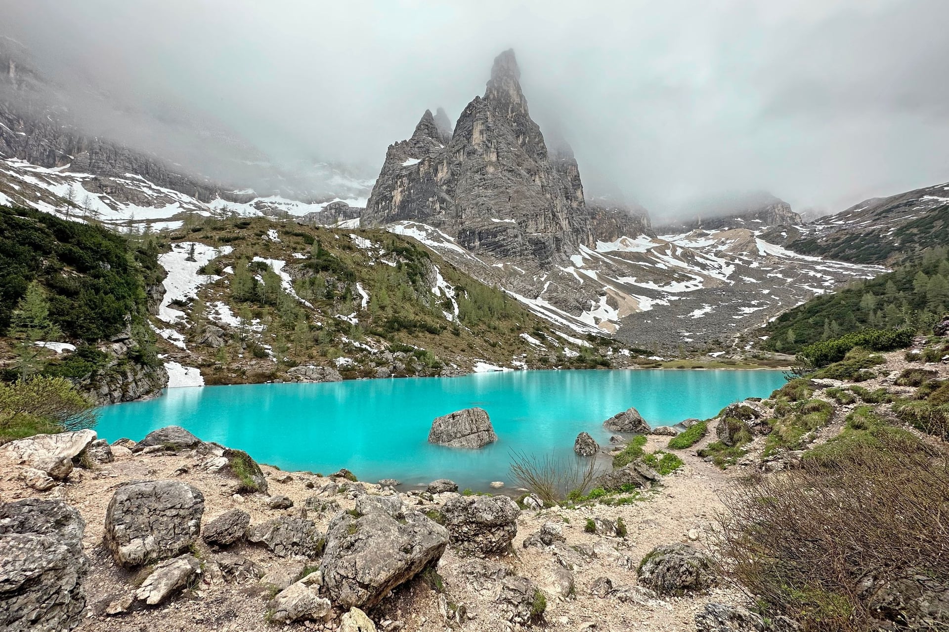
Under the walls of the Sorapis group, the lake lies at 1,925 m, and its milky blue colour comes from fine rock flour. Rifugio Vandelli, first built in 1890, stands beside the waterfall just below the lake.
The Cortina tourist board grades path 215 for experienced walkers because of its ladders and cable-protected ledge. Path 217 from the Val d'Ansiei avoids both, but it climbs more steeply. In July and August the lake is busy, so start early.
5. Cinque Torri and the Great War Open-Air Museum
Distance: about 2 km each way from Rifugio Scoiattoli to Rifugio Nuvolau, plus the trench paths
Time: about 1 hour up to Nuvolau; 20 minutes to 2 hours on the museum paths
Climb: 320 m, from 2,255 to 2,575 m
Terrain: easy trench paths, then a stony path past Rifugio Averau
Start: Rifugio Scoiattoli, by chairlift from Bai de Dones (1,889 m), on bus 52 from Cortina
Best for: First World War history and an easy first day high up
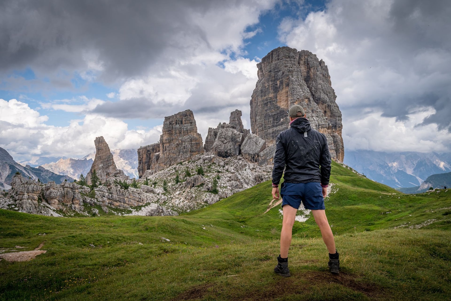
Five rock towers stand on open grass above Cortina, and soldiers lived in the trenches around them from 1915 to 1917. Four marked museum paths, from a 20-minute upper trench to a 2-hour round of the towers, start 5 minutes from Rifugio Scoiattoli.
From Scoiattoli a path climbs past Rifugio Averau to Rifugio Nuvolau (2,575 m) in about an hour. Built in 1883, Nuvolau is the oldest hut around Cortina. The chairlift ran from 6 June to 11 October in 2026.
6. Lago Federa and Croda da Lago
Distance: about 4.3 km each way
Time: about 2 hours up
Climb: about 340 m, from 1,708 to 2,046 m
Terrain: forest and pasture paths 437 and 434, closed to bikes
Start: the Ru Curto bridge on the Passo Giau road, on the route of bus 53 from Cortina in summer
Best for: a quiet lake below a rock wall, with lunch at the hut
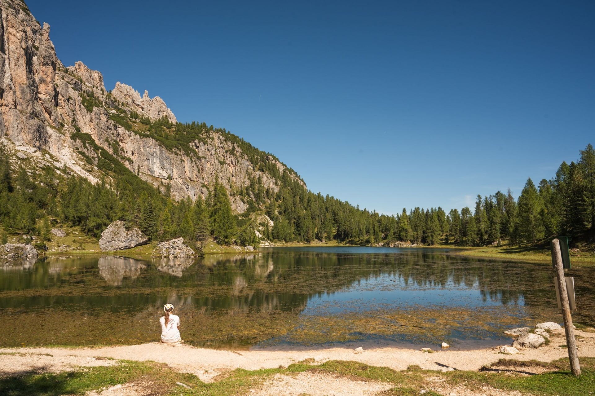
Rifugio Croda da Lago stands on the shore of Lago Federa at 2,046 m, under the 2,701 m Croda da Lago. A Cortina mountain guide, Giovanni Barbaria, built the first hut in 1901, and CAI Cortina has run it since 1920.
The shortest way up follows path 437 from the Ru Curto bridge to Cason di Formin, then 434 to the lake. A longer 12.1 km route from Passo Giau crosses the Mondeval pastures, where the 7,500-year-old skeleton of a prehistoric man was found in the 1980s.
7. Val Travenanzes Under the Tofane
Distance: about 17 km one way
Time: 6 to 7 hours
Climb: about 570 m up and 1,390 m down
Terrain: a rocky pass at 2,507 m, then a long valley path over stony riverbeds
Start: Passo Falzarego (2,105 m), by bus 52 from Cortina; the walk ends at Fiames, 4 km north of Cortina
Best for: fit walkers who want a whole day away from roads
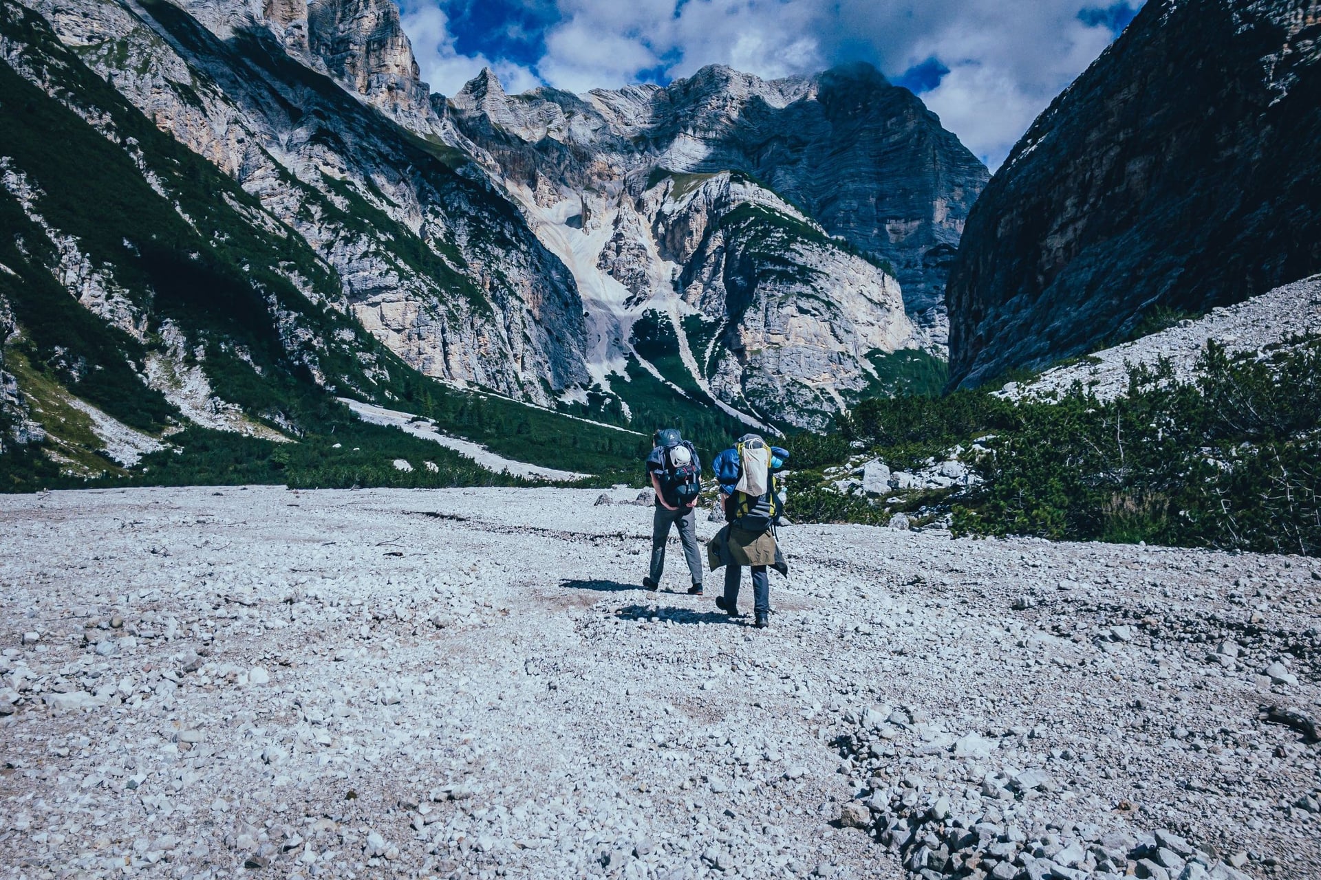
Val Travenanzes runs north between the Tofane and the Lagazuoi, and the front line of 1915 to 1917 crossed its head. Path 402 climbs from Passo Falzarego to Forcella Travenanzes (2,507 m), and path 401 then follows the valley down past Ponte Outo to Fiames.
For a shorter day in the same place, take the Lagazuoi cable car from Passo Falzarego. Paths 401 and 402 lead back down along the old front line: 4.7 km in 2 hours 15, with 681 m of descent.
8. Passo Gardena to the Puez Hut
Distance: 13.6 km, to the hut and down to Colfosco
Time: about 5 hours 15
Climb: 581 m up and 1,075 m down, with a high point of 2,529 m
Terrain: rocky paths over two passes and a bare plateau, graded moderate
Start: Passo Gardena (2,121 m), by summer bus from Corvara and the Alta Badia villages
Best for: fit walkers who want a day on a high stone plateau
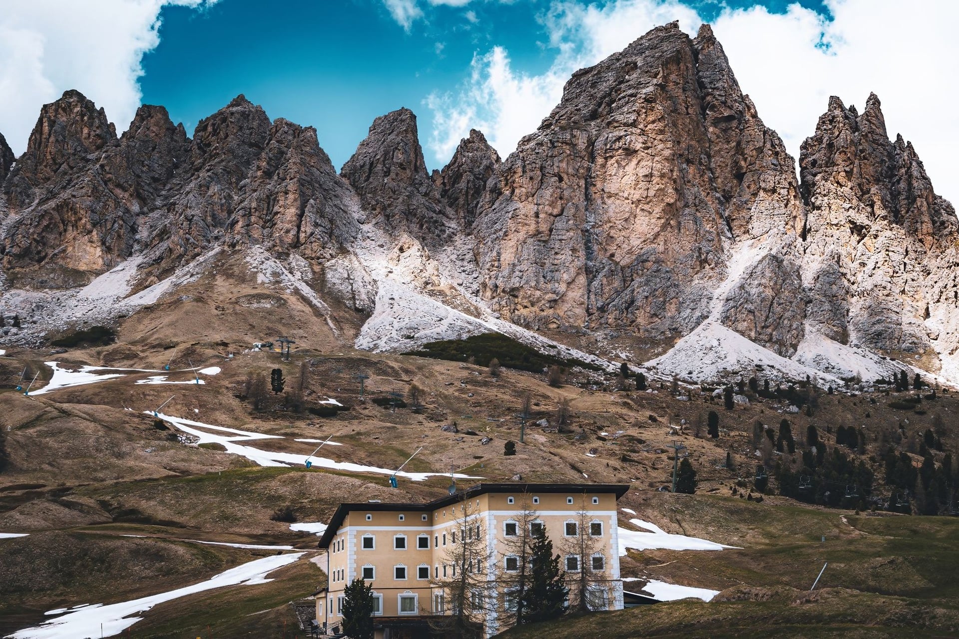
From Passo Gardena, path 2 climbs past the Jimmi hut to the Cir pass (2,464 m) and the Crespëina ridge. It then rises and falls over the plateau to Rifugio Puez (2,475 m), in the Puez-Odle nature park, part of the Dolomites World Heritage Site.
The German and Austrian Alpine Club built the first Puez hut in 1889. The way down follows path 4 through the Stella Alpina valley to Colfosco, next to Corvara. The Alta Badia tourist board grades the walk moderate, with no great technical difficulties, but the 1,075 m descent is long.
9. Alpe di Siusi (Seiser Alm) Meadows: Compatsch to Saltria
Distance: 4.5 km one way on path 30
Time: a little over an hour each way
Climb: gentle, between 1,674 and 1,917 m
Terrain: wide tracks, easy and suitable for pushchairs
Start: Compatsch, 15 minutes from Seis on the Seiser Alm cable car; Almbus 11 back from Saltria
Best for: older walkers and families
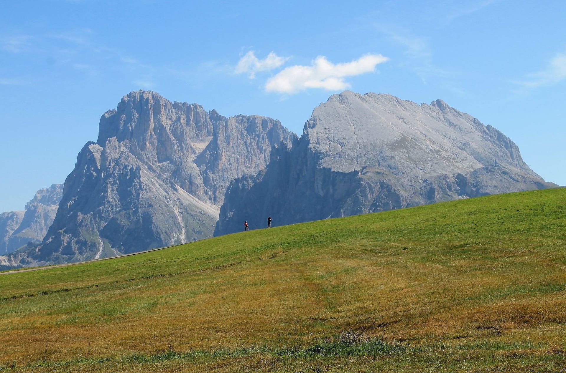
The Alpe di Siusi covers 56 km², and the local tourist board calls it the largest high-Alpine pasture in Europe. The Hans and Paula Steger path crosses it from the church at Compatsch to the hamlet of Saltria.
It is named after two climbing pioneers who turned the Dellai hut into a hotel after the Second World War. Under the Seiser Alm road rules, private cars may drive up only before 9:00 and after 17:00 with a booking, so the cable car is the simple way up. All the plateau routes are in our Alpe di Siusi walks guide.
10. Lago di Carezza Below the Latemar
Distance: 3.8 km on the long loop, or a short circuit of the shore
Time: about 1 hour
Climb: 98 m, between 1,540 and 1,636 m
Terrain: forest paths above the lake, and a fenced viewing path at the shore
Start: the lake stop on bus 180 from Bolzano, which runs hourly
Best for: a short walk on a travel day
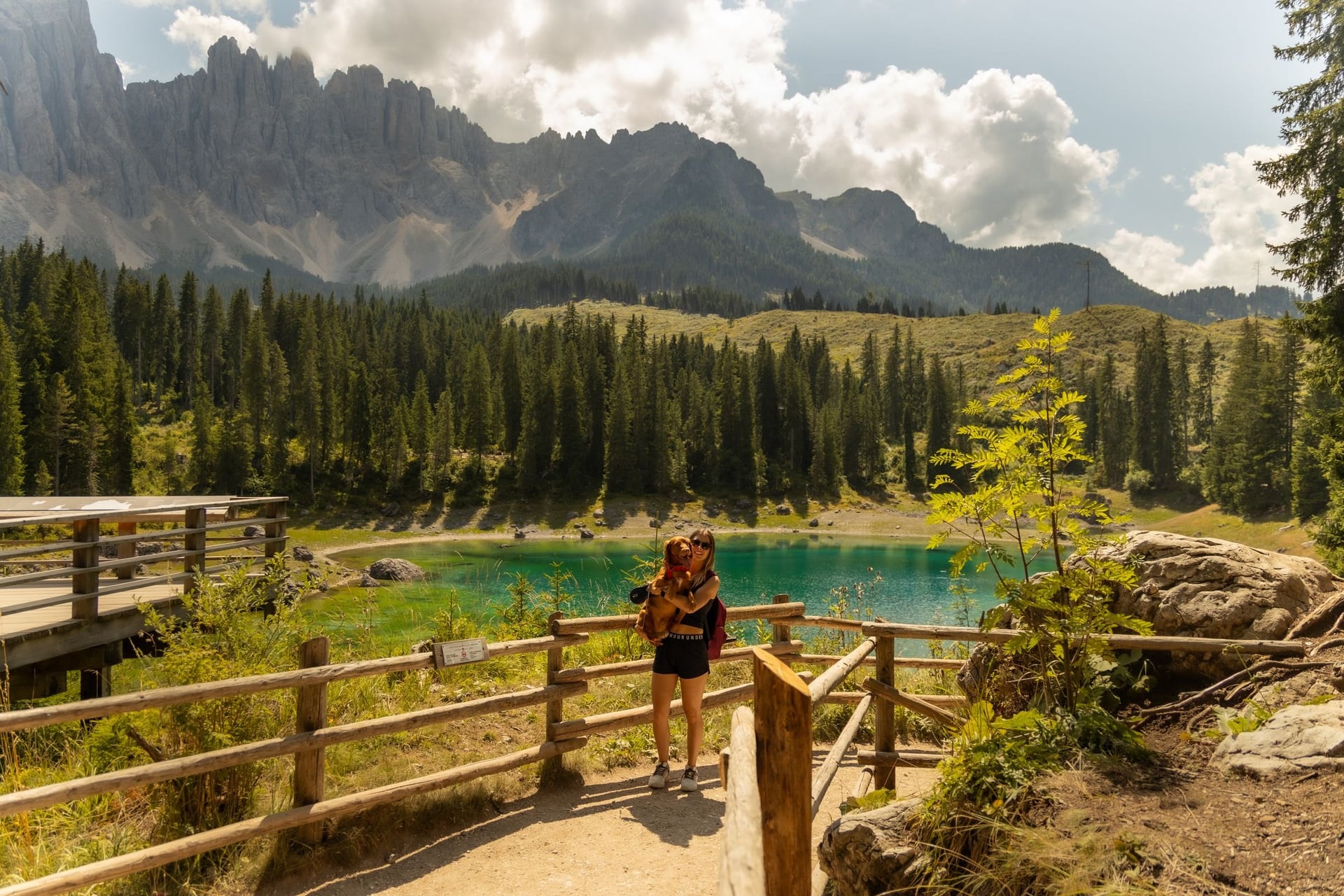
Springs from the Latemar feed Lago di Carezza, a small lake at 1,520 m that is 300 m long and up to 22 m deep. The long loop climbs into the forest above it, and the short circuit stays at the shore.
The lake is a protected natural monument, so you may not cross the fences or swim. Bus 180 runs hourly from Bolzano through Nova Levante to the Costalunga pass and stops at the lake. Our easy walks guide describes the short loop.
11. Altopiano delle Pale and Rifugio Rosetta
Distance: about 4 km each way from Rifugio Rosetta to the Fradusta glacier
Time: 4 hours return on path 709
Climb: rolling ground between about 2,540 and 2,704 m
Terrain: bare limestone on marked paths, with a few exposed stretches above steep drops but no cables
Start: Rifugio Rosetta (2,581 m), 15 minutes from the Rosetta cable car above San Martino di Castrozza
Best for: a high plateau without a long climb, from late June to September
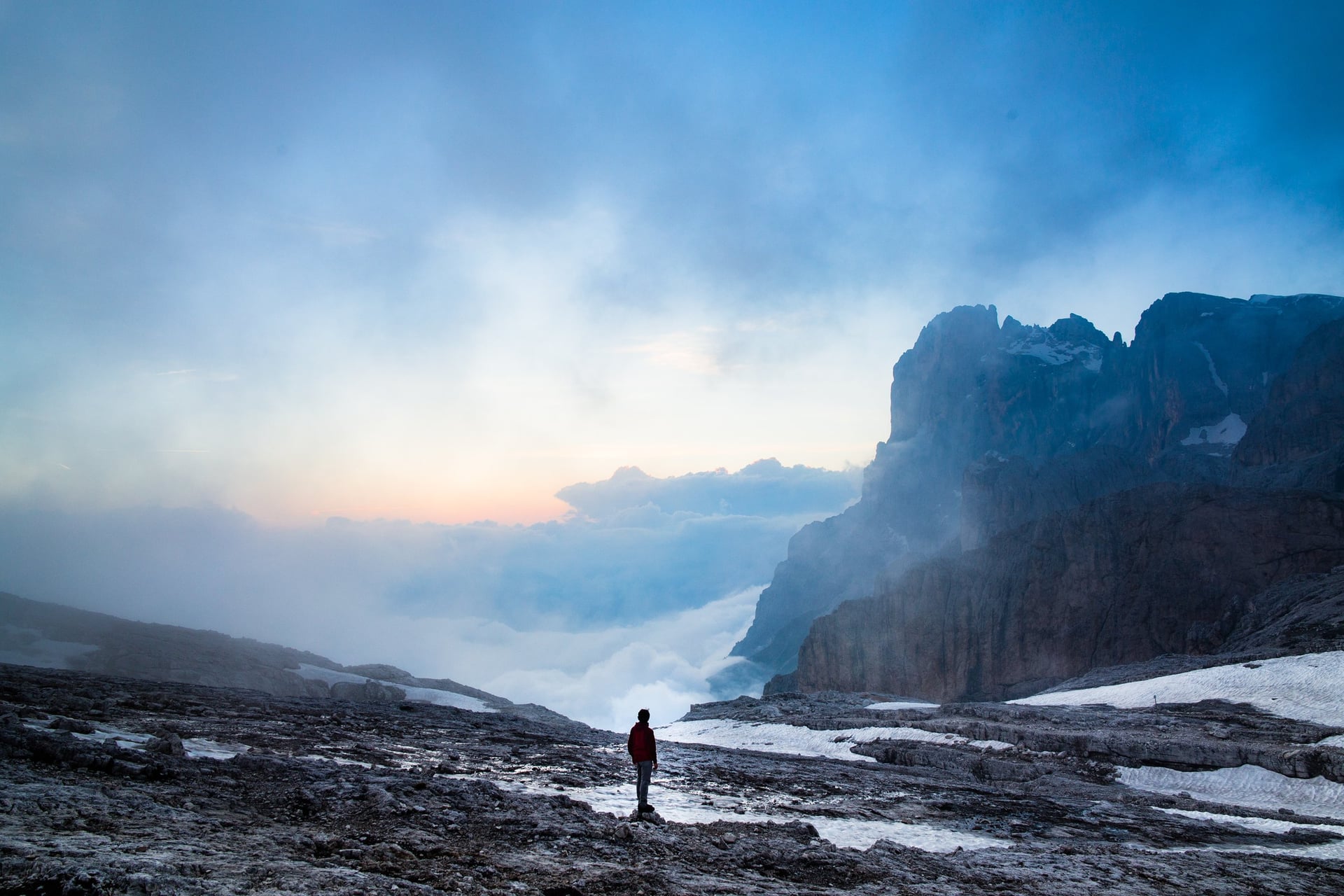
Above San Martino di Castrozza, the Pale di San Martino hold a high plateau of bare limestone, crossed by marked paths. The SAT built Rifugio Rosetta on its western edge in 1889, and the cable car followed in 1957.
Path 709 crosses the plateau to the small Fradusta glacier and back in about four hours. Check the last ride down before you go: in 2026 the Rosetta cable car stopped at 16:40, with a break from 13:00 to 13:40.
12. Baita Segantini and the Colbricon Lakes
Distance: 3 km to Baita Segantini; the lakes lie 40 to 60 minutes from Malga Rolle
Time: about 1 hour to the hut
Climb: about 200 m to the hut; almost level to the lakes
Terrain: a gravel track to the hut, and an easy path through larch and fir to the lakes
Start: Passo Rolle (1,984 m), 15 minutes by bus from San Martino di Castrozza
Best for: two short walks in one day
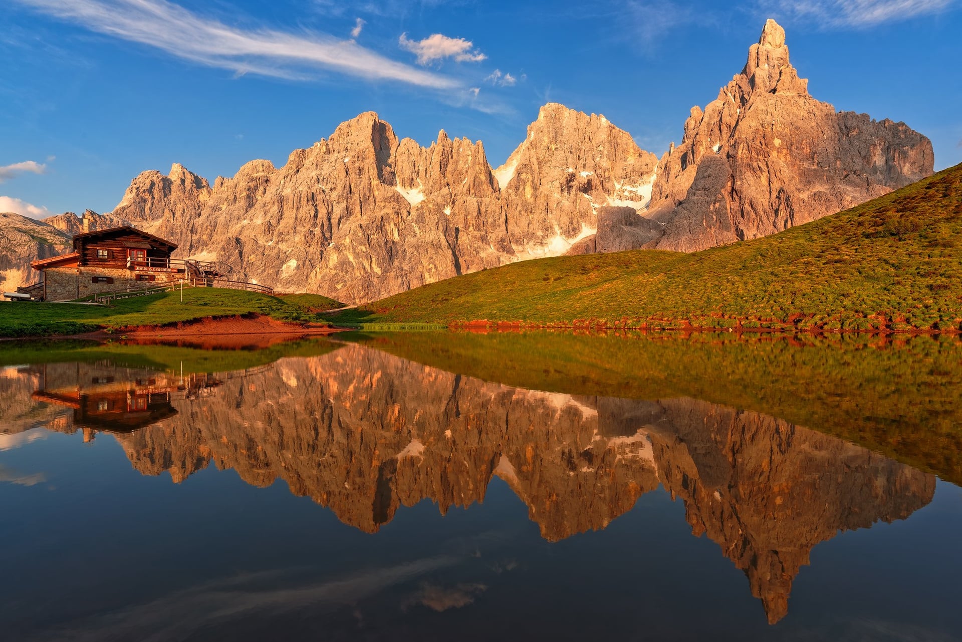
Baita Segantini (2,182 m) faces the Cimon della Pala (3,186 m), which locals call the Matterhorn of the Dolomites. The track from Passo Rolle climbs about 200 m in an hour.
On the other side of the pass, path 348 leaves Malga Rolle for the two Colbricon lakes, at about 1,909 and 1,922 m, where a small hut opens in summer. The front line of the First World War ran here, and flint tools left by hunters about 10,000 years ago were found by the lakes in the 1970s.
How Hard Is Walking in the Dolomites?
Most walks here follow well-made, waymarked paths with no technical ground, and the effort comes from the height you gain and lose.
Height Gain and Walking Times
Height gain sets the pace more than distance. Alpine clubs plan walks at 4 km an hour on the flat, 300 m an hour uphill and 500 m an hour downhill. You work out both times, halve the smaller one and add it to the larger.
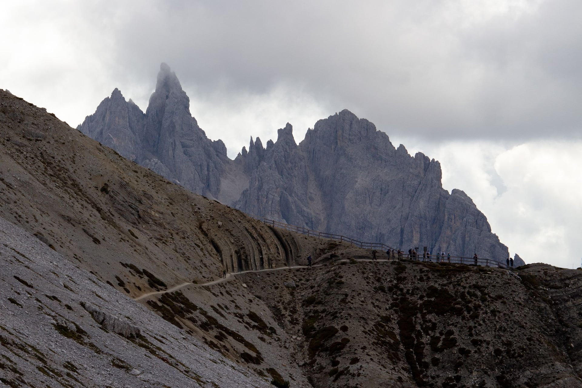
By that rule the Tre Cime loop, about 10 km with about 400 m of climb, takes three and a half hours, close to the 3 to 4 hours the Auronzo tourism portal gives. Signposts here usually give walking times instead of distances, so plan your day on those times.
Lifts and Buses That Shorten the Day
Lifts remove the steepest climbs. The Seiser Alm cable car takes you from Seis to Compatsch in 15 minutes, and chairlifts west of Cortina put you straight onto the high meadows. In the south, the Colverde gondola and Rosetta cable car lift you from San Martino di Castrozza to within 15 minutes of Rifugio Rosetta at 2,581 m.
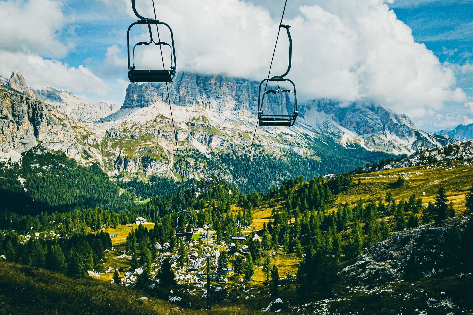
Most lifts run from early or mid June to late September or early October, and most of those on these walks stop running between 16:40 and 17:30. Summer buses reach the passes as well: lines 51, 52 and 53 ran from Cortina to Passo Tre Croci, Passo Falzarego and the Giau road from 8 June to 9 September 2026.
Exposed Sections and Easy Alternatives
Only a few of these walks have exposed ground. Lago di Sorapis has ladders and a cable-protected ledge on path 215, the Dürrenstein above Prato Piazza has short secured passages, and the Pale plateau has stretches above steep drops without cables.
The flattest walks are the Lago di Braies loop, with about 40 m of climb, the Steger path on the Alpe di Siusi and the 20-minute track from Rifugio Auronzo to Rifugio Lavaredo. Our easy walks guide adds lake loops at Dobbiaco, Misurina and Carezza.
Waymarks, Storms and Mountain Rescue
Paths carry red and white CAI waymarks, and every junction has a signpost with the path number. Tabacco 1:25,000 walking maps use the same numbers. The CAI grades paths T for easy tracks, E for ordinary mountain paths and EE for steep or unstable ground that needs a sure foot.
The CAI advises starting early, because afternoon thunderstorms are common in summer. In an emergency call 112 and ask for the mountain rescue; the alpine distress signal is six signals a minute, repeated after a minute's pause.
Where to Stay: Five Walking Bases
Choose a base by the walks you want from its door, because each valley has its own lifts and buses and crossing between valleys takes time. Hotel types and booking tips are in our guide to accommodation in the Dolomites.
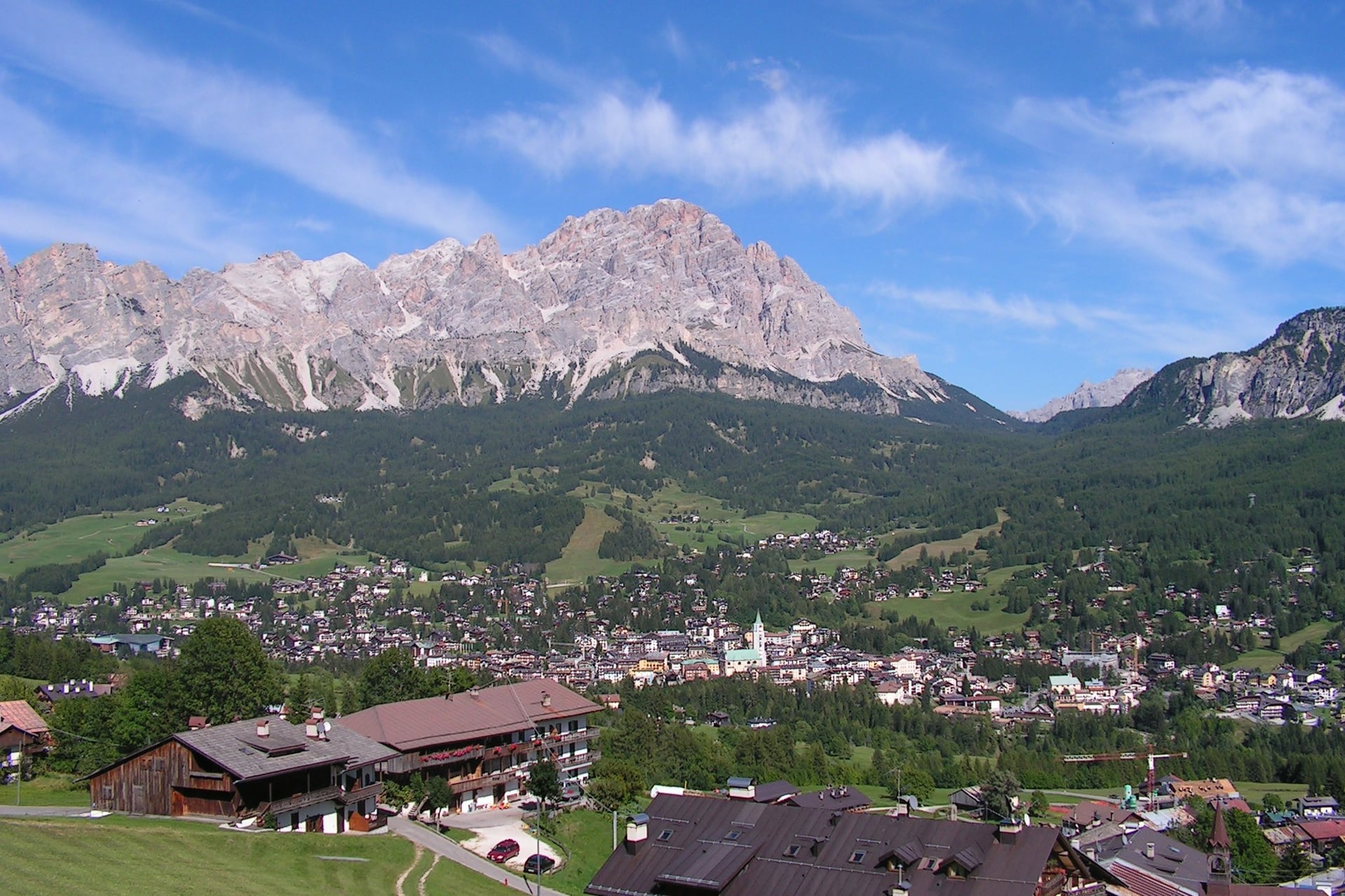
A week fits two of the five bases, because no single valley reaches all twelve walks. Dobbiaco and Cortina are about an hour apart by bus, while San Martino di Castrozza sits on its own in the south.
Dobbiaco, Corvara and Ortisei lie in South Tyrol, where many hotels include the Südtirol Guest Pass for buses and regional trains. Cortina is in the Veneto and San Martino di Castrozza in Trentino, so the pass does not apply there.
A village at 1,219 m with a station on the Puster Valley Railway, which makes it the simplest base without a car. Bus 442 runs to Lago di Braies, bus 443 to Prato Piazza and, in 2026, bus 444 ran to Rifugio Auronzo. Walks 1 to 3.
A town at 1,224 m with a direct coach from Venice airport in about 2 hours. Summer buses 51, 52 and 53 reach Passo Tre Croci, Passo Falzarego and the Giau road, and the Misurina shuttle continues to the Tre Cime. Walks 3 to 7.
The main village of Alta Badia, at 1,568 m, between the Sella group and the Puez-Odle nature park. The Boè gondola leaves from the village, Lech de Boè is 20 minutes from its top, and summer buses climb to Passo Gardena. Walk 8.
The main town of Val Gardena, with a gondola to the Alpe di Siusi and bus 172 to the Seiser Alm cable car at Seis. Kastelruth and Seis, below the plateau, are quieter options for the same meadows. Walk 9.
A resort at about 1,450 m below the Pale di San Martino, with the Colverde gondola and Rosetta cable car in the village. Buses reach Passo Rolle in 15 minutes, and Feltre station is 45 km away. Walks 11 and 12.
Nights in a Mountain Hut
A night in a rifugio, a staffed mountain hut, puts you on the high paths at first light. Most open from mid or late June to late September, sleep walkers in dormitories or shared rooms, and serve dinner and breakfast.
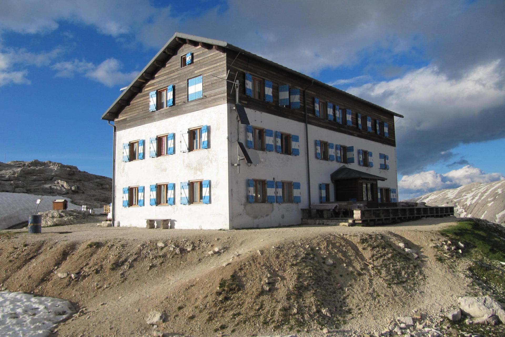
Rifugio Croda da Lago (2,046 m): 50 beds in rooms of 6 or 9 and one 15-bed dormitory, open 15 June to 25 October 2026; a sleeping-bag liner is compulsory
Rifugio Puez (2,475 m): 45 places in four dormitories with triple bunks, open from 4 June; blankets on every bed, with hut sleeping bags for hire
Rifugio Rosetta (2,581 m): 70 beds in rooms of 4 to 8, open 20 June to 27 September 2026; bring your own sleeping bag
Book early, because huts such as Rifugio Puez take bookings online only, and Rifugio Locatelli warns that replies can take up to three weeks. Multi-day hut routes such as the Alta Via 1 link huts like these for a week or more; our sister company covers that route in its Alta Via 1 guide.
Best Time to Walk
The walking season runs from June to early October, when the lifts and huts are open and the high paths are clear.
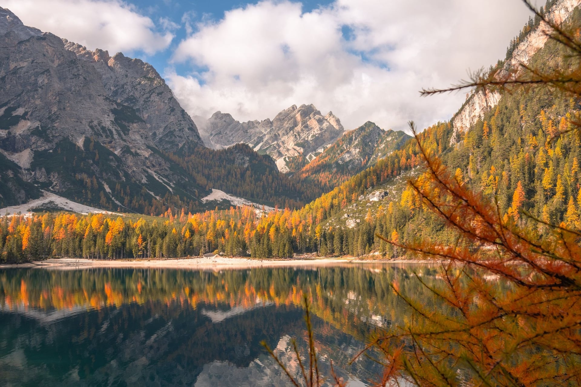
Each month changes what is open as much as the weather. Lifts start between late May and late June and close from late September, the summer bus lines to the passes start on 8 June, and the Braies access rules cover high summer. The figures in the cards are long-term averages from the South Tyrol weather service, for Dobbiaco at 1,219 m and the Zallinger station at 2,051 m on the Alpe di Siusi.
Dobbiaco averages 20.1 °C by day and 7.2 °C at night; at 2,051 m it is 15.1 °C and 6.7 °C. Lifts open through the month: the Seiser Alm cable car from 22 May, the Cinque Torri chairlift from 6 June and the Rosetta cable car from 20 June in 2026. Dobbiaco has 13 rain days.
The warmest and busiest months: 22.6 °C by day in Dobbiaco in July, and 17.1 °C at 2,051 m. They are also the wettest months high up, with 198 mm of rain in July at 2,051 m. The Braies access rules apply from 1 July.
Dobbiaco averages 18.1 °C by day and 5.4 °C at night, and rain days fall to 8. The Braies rules end on 15 September, but the Cortina bus lines thin out from 10 September and the Rosetta cable car closed on 27 September in 2026.
Days reach 12.9 °C in Dobbiaco and 8.6 °C at 2,051 m, with 7 rain days. A few lifts still run, such as the Cinque Torri chairlift to 11 October, and the larch forests around Prato Piazza turn gold. Rifugio Croda da Lago stays open to 25 October.
June and September are the calmest months for walking, with open lifts and fewer people than in high summer. Our guide on when to visit the Dolomites goes through every month.
Know Before You Arrive
A walking week here runs on trains, valley buses and lift timetables, and you can plan it without a car.
Getting There Without a Car
Every base can be reached by regional train and valley bus, and Dobbiaco is the only one with its own station.
Dobbiaco: a station on the Puster Valley Railway between Fortezza and San Candido
Cortina d'Ampezzo: a direct coach from Venice Marco Polo airport in about 2 hours, or Dolomiti Bus line 30 from Calalzo station
Ortisei and the Alpe di Siusi: bus 350 from Ponte Gardena or Chiusa stations to Ortisei, and bus 170 from Bolzano to the cable car at Seis
Corvara: buses from Brunico station on the Puster Valley Railway
San Martino di Castrozza: Trentino Trasporti buses from Feltre station, 45 km away
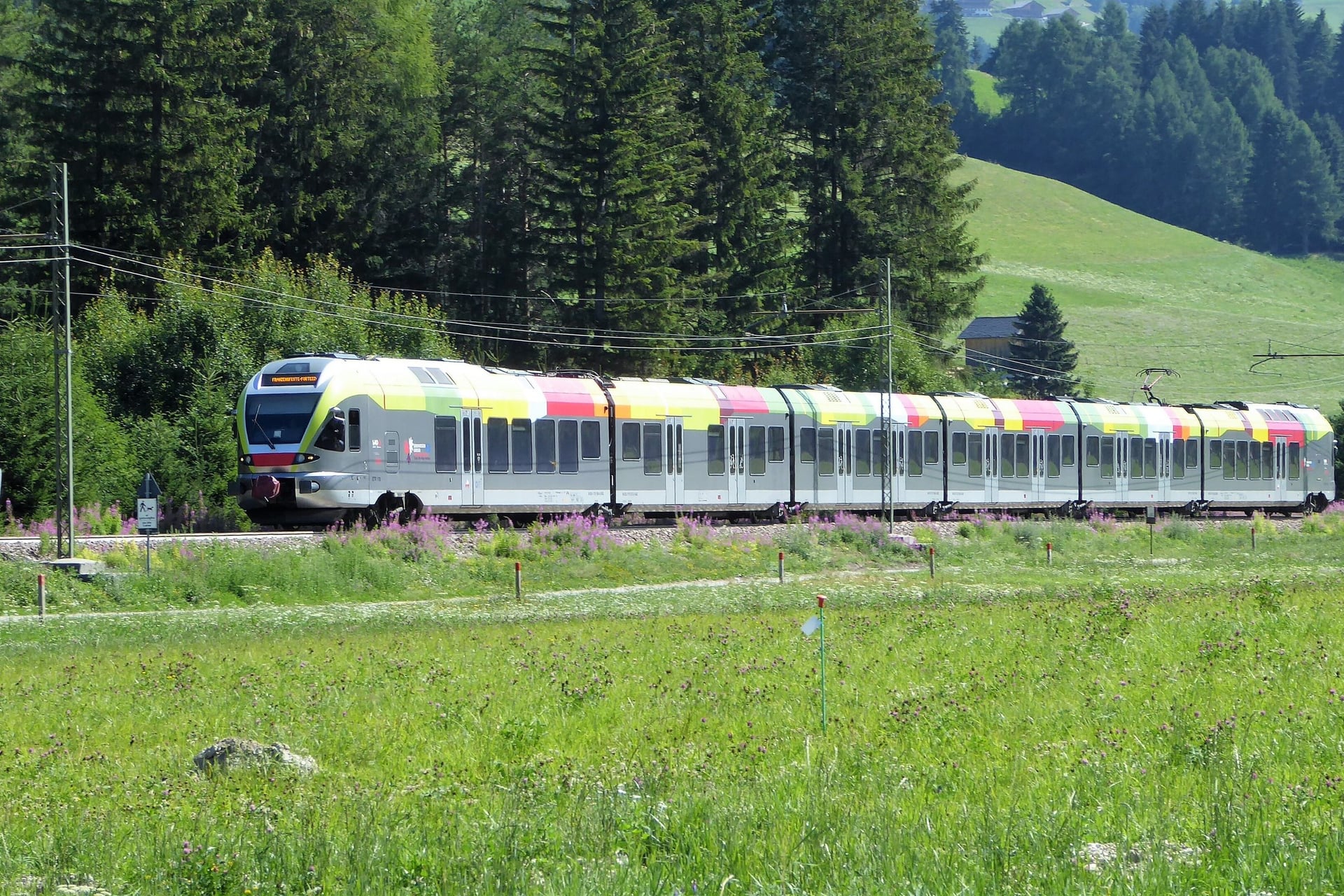
Three of the busiest places limit cars in summer. The Seiser Alm road is closed to private cars from 9:00 to 17:00. The Braies valley needs a booking from 9:00 to 16:00 between 1 July and 15 September, and the Tre Cime toll road opens only to cars booked online.
Many South Tyrol hotels include the Südtirol Guest Pass, which covers regional trains, buses and selected cable cars, though not the Braies buses during the summer rules. Our guide on how to get to the Dolomites has the flights and transfers.
How Much It Costs
Walking costs nothing here; the money goes on lifts, buses, parking and huts, and a hut night with half board is the biggest single cost.
Item | Price, 2026 | Notes |
Seiser Alm cable car, Seis to Compatsch | €30 return, €21 single | 22 May to 2 November |
Cinque Torri chairlift | €27.50 return, €30 in August | 6 June to 11 October |
Colverde gondola and Rosetta cable car | €34 return | 20 June to 27 September |
Dolomiti Supersummer points card | €100 for 1,000 points | Shareable; not valid in Val Gardena |
Tre Cime shuttle bus from Misurina | €10 day ticket | Card or app, no cash on board |
Tre Cime toll road | €40 per car | Booked online with the number plate |
Mobilcard, South Tyrol buses and trains | €32 for 3 days, €52 for 7 | Not valid on long-distance trains |
Half board in a hut | €73 to €90 | Croda da Lago, Rosetta and Puez, non-members |
At Lago di Braies, a combined ticket of €44 covers the valley permit, a parking place and a €22 voucher for the restaurant or shop. CAI and other alpine club members pay less in the huts, €58.50 to €72 for half board.
What to Pack
Above 2,000 m the weather is cooler and changes fast: the Alpe di Siusi averages 17.1 °C on a July day at 2,051 m, so pack for cold and rain even on a meadow walk.
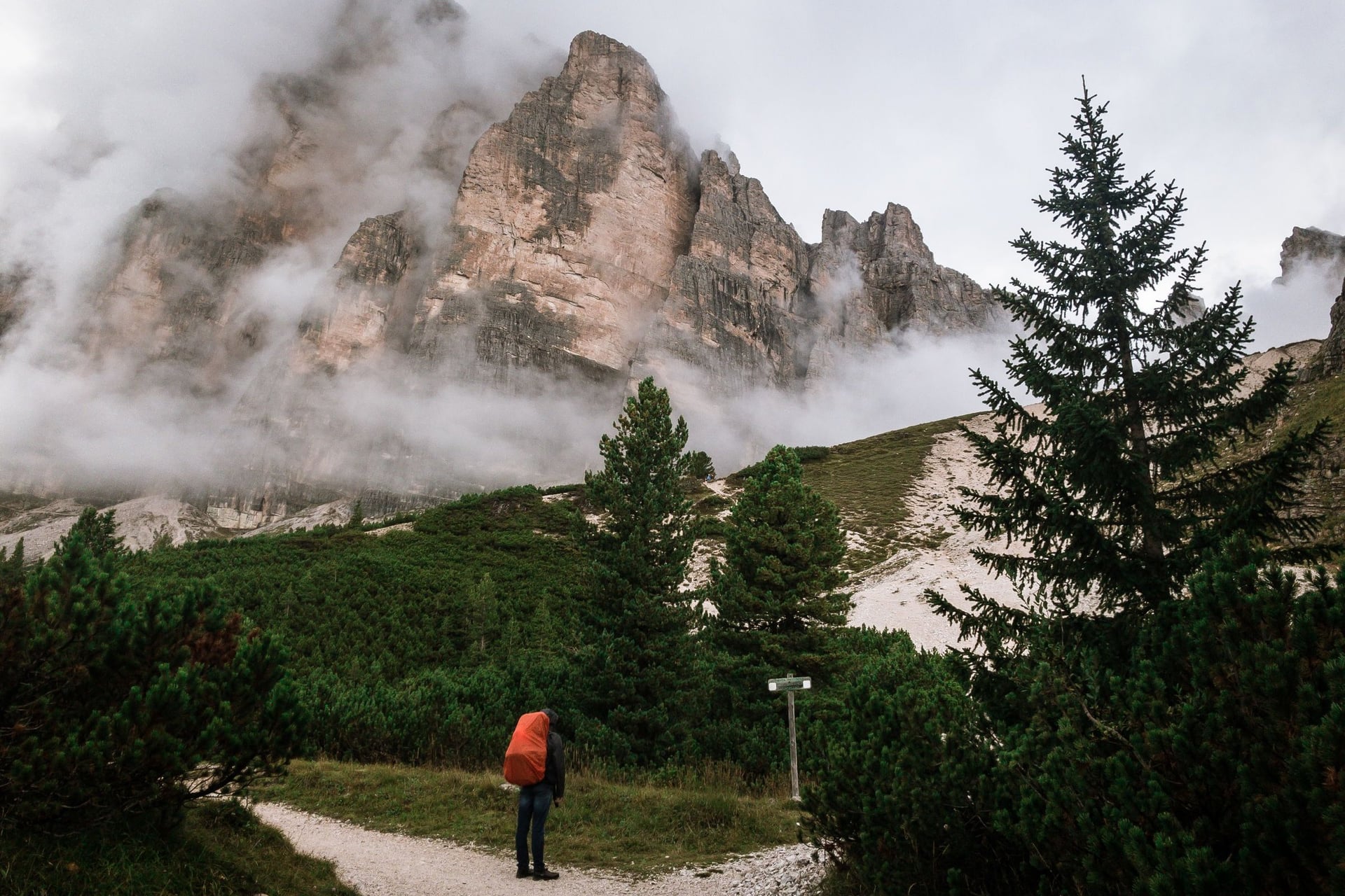
For any mountain day walk:
Walking boots with grip on wet rock, already worn in
A waterproof jacket, a warm layer, a hat and gloves
Sun hat, sunglasses and sun cream for long days above the tree line
Water, snacks and a first-aid kit, with blister plasters
For the Dolomites:
Walking poles for the long descents, such as 1,075 m from Puez to Colfosco or 681 m from the Lagazuoi to Passo Falzarego
Euros in cash for huts and buses that take no cards, such as Rifugio Locatelli and bus 443 to Prato Piazza
A sleeping-bag liner for hut nights; Rifugio Rosetta asks for your own sleeping bag
A 1:25,000 walking map, such as Tabacco or Kompass, or an offline map app
A light down jacket for the high plateaux at Puez and the Pale di San Martino
Which Walks Fit Into One Week?
Walks 1 to 7 all start within a bus ride of Dobbiaco or Cortina, so a week split between the two covers the lakes, the Tre Cime, the Cinque Torri and Val Travenanzes. The catch is the booking: in July and August the Braies and Tre Cime buses from Dobbiaco must be reserved online, and some huts take weeks to confirm a bed.
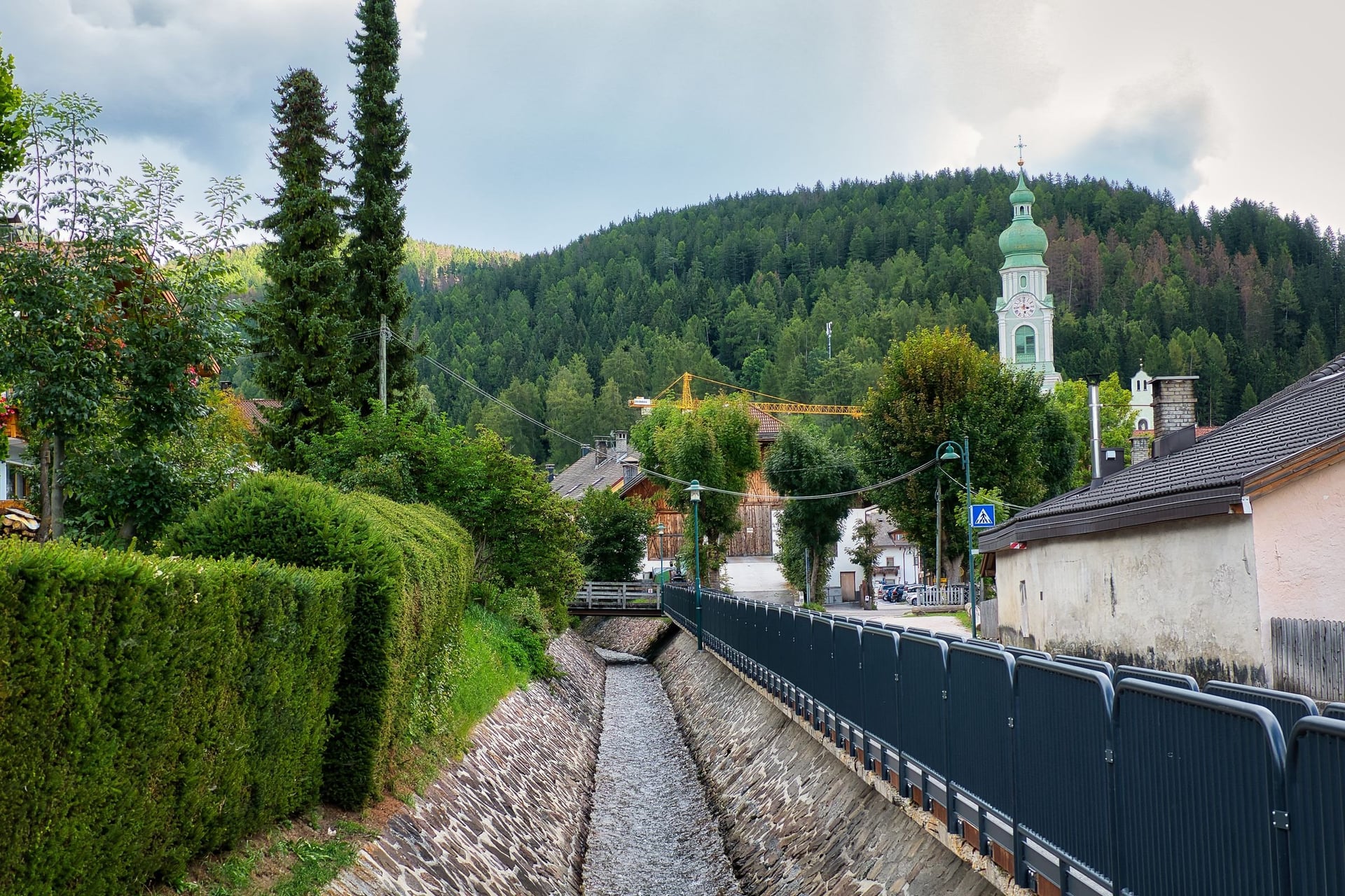
Our self-guided walking holidays in the Dolomites book that chain for you: the hotels, the route for each day in a GPS app and a digital guidebook, and support while you walk. Three of them cover the walks above:
Alta Pusteria Walking Holidays: 8 days / 7 nights from Dobbiaco, six walking days of 8.5 to 20.5 km, with Lago di Braies on day 4 and the Tre Cime loop on day 7
Cortina d'Ampezzo week: 7 days / 6 nights in one Cortina hotel, with Monte Faloria, the Cinque Torri, the Tre Cime and Lago di Sorapis on days 2 to 5
Alpe di Siusi Inn to Inn: 7 days / 6 nights from Kastelruth to Ortisei, with luggage moved between hotels and Compatsch to Saltria on day 5
Each includes hotels with breakfast and the GPS navigation app. Ask us about dates for next summer.
Whichever valley you start in, the best days end the same way: back in the village at dusk, when the pale walls above it turn pink for a few minutes before dark.
Frequently Asked Questions



Plan with a hiking expert
Free advice from a team that knows these routes inside out - real people, not a bot

Hassle-Free
We handle route planning, accommodations, transfers, and anything else you prefer not to deal with, so you can enjoy a carefree hike.

Book With Confidence
We are a financially protected company, fully bonded and insured, keeping your money safe and allowing you to travel with confidence.

Tried & Tested Adventures
Only the best hiking adventures in Slovenia, cherry-picked by our local team with an in-depth knowledge of the region.

Unbeatable Support
Our 24/7 customer support is where we show our passion, bringing you a better experience by making your well-being our number one priority.